
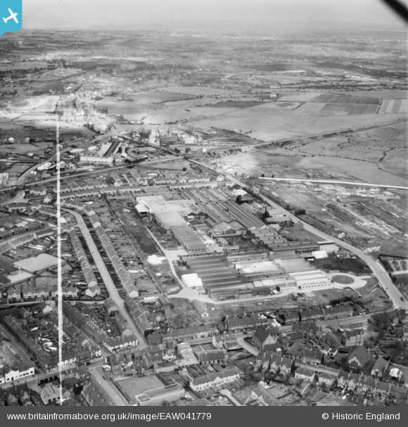
EAW041779 ENGLAND (1952). The John Harper and Co Ltd Albion Engineering Works, Willenhall, from the south-west, 1952. This image was marked by Aerofilms Ltd for photo editing.
© Copyright OpenStreetMap contributors and licensed by the OpenStreetMap Foundation. 2026. Cartography is licensed as CC BY-SA.
Nearby Images (18)
EAW041779

EAW008384

EAW008385

EAW008388

EAW008387

EAW008386

EAW008383

EAW008390

EAW008386A

EAW041778

EAW041770

EAW008382

EAW041771

EAW008389

EAW008381

EAW041775

EPW061255

EAW041773

Details
| Title | [EAW041779] The John Harper and Co Ltd Albion Engineering Works, Willenhall, from the south-west, 1952. This image was marked by Aerofilms Ltd for photo editing. |
| Reference | EAW041779 |
| Date | 23-February-1952 |
| Link | |
| Place name | WILLENHALL |
| Parish | |
| District | |
| Country | ENGLAND |
| Easting / Northing | 397236, 298745 |
| Longitude / Latitude | -2.0408007881516, 52.586146758515 |
| National Grid Reference | SO972987 |
Pins

redmist |
Wednesday 12th of October 2022 02:30:22 PM | |
|
Dave |
Sunday 2nd of August 2020 10:45:45 PM | |
|
KevTheBusDriver |
Sunday 28th of June 2015 10:03:15 PM | |
|
KevTheBusDriver |
Sunday 28th of June 2015 10:02:37 PM |