
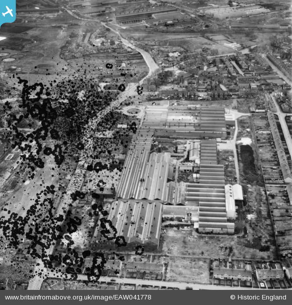
EAW041778 ENGLAND (1952). The John Harper and Co Ltd Albion Engineering Works, Willenhall, 1952. This image has been produced from a damaged negative.
© Copyright OpenStreetMap contributors and licensed by the OpenStreetMap Foundation. 2026. Cartography is licensed as CC BY-SA.
Nearby Images (17)
EAW041778

EAW008389

EAW041775

EAW041771

EAW008383

EAW008386A

EAW008386

EAW008387

EAW041770

EAW008384

EAW008390

EAW041773

EAW008385

EAW008388

EAW041779

EAW041777

EPW061255

Details
| Title | [EAW041778] The John Harper and Co Ltd Albion Engineering Works, Willenhall, 1952. This image has been produced from a damaged negative. |
| Reference | EAW041778 |
| Date | 23-February-1952 |
| Link | |
| Place name | WILLENHALL |
| Parish | |
| District | |
| Country | ENGLAND |
| Easting / Northing | 397347, 298885 |
| Longitude / Latitude | -2.0391633839742, 52.587406029661 |
| National Grid Reference | SO973989 |
