
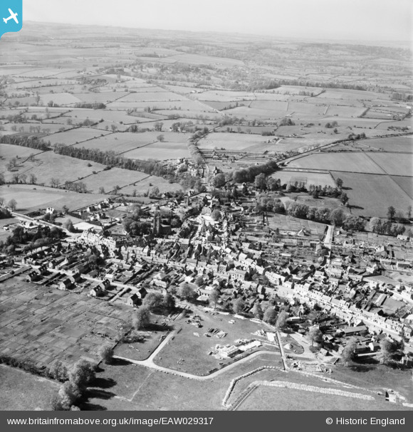
EAW029317 ENGLAND (1950). The town centre, Stow-on-the-Wold, from the south-east, 1950
© Copyright OpenStreetMap contributors and licensed by the OpenStreetMap Foundation. 2026. Cartography is licensed as CC BY-SA.
Nearby Images (18)
EAW029317

EAW029318

EPW026888

EAW048948

EAW014922

EPW026890

EAW048953

EPW026892

EAW014920

EAW029316

EAW014921

EPW026894

EPW026893

EAW048949

EAW014919

EPW026891

EAW029315

EPW026887

Details
| Title | [EAW029317] The town centre, Stow-on-the-Wold, from the south-east, 1950 |
| Reference | EAW029317 |
| Date | 11-May-1950 |
| Link | |
| Place name | STOW-ON-THE-WOLD |
| Parish | STOW-ON-THE-WOLD |
| District | |
| Country | ENGLAND |
| Easting / Northing | 419235, 225566 |
| Longitude / Latitude | -1.7202352539302, 51.927843533928 |
| National Grid Reference | SP192256 |


