
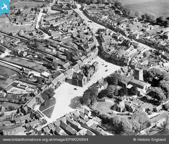
EPW026894 ENGLAND (1929). The Market Square, Stow-on-the-Wold, 1929
© Copyright OpenStreetMap contributors and licensed by the OpenStreetMap Foundation. 2026. Cartography is licensed as CC BY-SA.
Nearby Images (19)
EPW026894

EAW014919

EAW029316

EAW048949

EAW048953

EPW026892

EPW026893

EPW026891

EAW048952

EAW048948

EPW026890

EAW029315

EPW026887

EAW014920

EAW048951

EAW014921

EAW048950

EAW029317

EAW014922

Details
| Title | [EPW026894] The Market Square, Stow-on-the-Wold, 1929 |
| Reference | EPW026894 |
| Date | May-1929 |
| Link | |
| Place name | STOW-ON-THE-WOLD |
| Parish | STOW-ON-THE-WOLD |
| District | |
| Country | ENGLAND |
| Easting / Northing | 419171, 225779 |
| Longitude / Latitude | -1.721154224862, 51.929760983555 |
| National Grid Reference | SP192258 |


