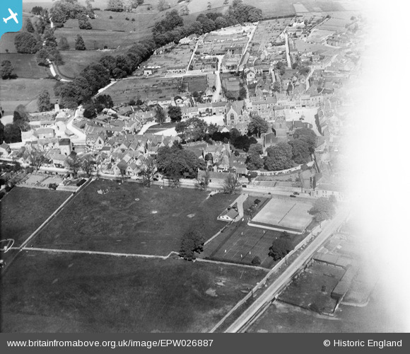
EPW026887 ENGLAND (1929). The town centre, Stow-on-the-Wold, 1929
© Copyright OpenStreetMap contributors and licensed by the OpenStreetMap Foundation. 2026. Cartography is licensed as CC BY-SA.
Nearby Images (17)
EPW026887

EAW029315

EPW026891

EPW026893

EAW048949

EAW048950

EAW029316

EPW026892

EAW014920

EPW026894

EPW026890

EAW014919

EAW048953

EAW048952

EAW048948

EAW048951

EAW029317

Details
| Title | [EPW026887] The town centre, Stow-on-the-Wold, 1929 |
| Reference | EPW026887 |
| Date | May-1929 |
| Link | |
| Place name | STOW-ON-THE-WOLD |
| Parish | STOW-ON-THE-WOLD |
| District | |
| Country | ENGLAND |
| Easting / Northing | 419034, 225792 |
| Longitude / Latitude | -1.7231461709297, 51.929882579161 |
| National Grid Reference | SP190258 |
Pins

Class31 |
Saturday 16th of August 2014 07:34:28 AM | |
|
Class31 |
Saturday 16th of August 2014 07:33:08 AM | |
|
Class31 |
Saturday 16th of August 2014 07:28:43 AM | |
|
Class31 |
Saturday 16th of August 2014 07:28:00 AM | |
|
Class31 |
Saturday 16th of August 2014 07:21:06 AM | |
|
Class31 |
Friday 15th of August 2014 05:44:39 PM | |
|
Class31 |
Friday 15th of August 2014 05:42:33 PM |