
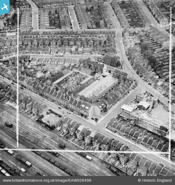
EAW028496 ENGLAND (1950). H.W. Nevill Ltd Bakery on Milkwood Road and environs, Herne Hill, 1950. This image was marked by Aerofilms Ltd for photo editing.
© Copyright OpenStreetMap contributors and licensed by the OpenStreetMap Foundation. 2026. Cartography is licensed as CC BY-SA.
Nearby Images (9)
EAW028496

EAW028498

EAW028491

EAW028492

EAW028493

EAW028495

EAW028497

EAW028490

EAW028494

Details
| Title | [EAW028496] H.W. Nevill Ltd Bakery on Milkwood Road and environs, Herne Hill, 1950. This image was marked by Aerofilms Ltd for photo editing. |
| Reference | EAW028496 |
| Date | 5-April-1950 |
| Link | |
| Place name | HERNE HILL |
| Parish | |
| District | |
| Country | ENGLAND |
| Easting / Northing | 532010, 175229 |
| Longitude / Latitude | -0.099585049060551, 51.46013430265 |
| National Grid Reference | TQ320752 |
Pins

Brumar |
Sunday 1st of March 2015 10:33:12 AM |