
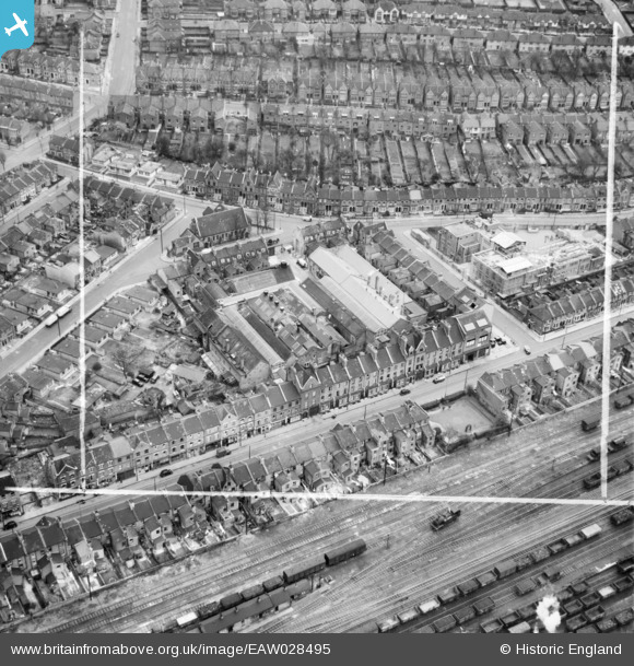
EAW028495 ENGLAND (1950). H.W. Nevill Ltd Bakery on Milkwood Road and environs, Herne Hill, 1950. This image was marked by Aerofilms Ltd for photo editing.
© Copyright OpenStreetMap contributors and licensed by the OpenStreetMap Foundation. 2026. Cartography is licensed as CC BY-SA.
Nearby Images (9)
EAW028495

EAW028493

EAW028492

EAW028490

EAW028496

EAW028497

EAW028498

EAW028494

EAW028491

Details
| Title | [EAW028495] H.W. Nevill Ltd Bakery on Milkwood Road and environs, Herne Hill, 1950. This image was marked by Aerofilms Ltd for photo editing. |
| Reference | EAW028495 |
| Date | 5-April-1950 |
| Link | |
| Place name | HERNE HILL |
| Parish | |
| District | |
| Country | ENGLAND |
| Easting / Northing | 532018, 175250 |
| Longitude / Latitude | -0.099462107325198, 51.460321176486 |
| National Grid Reference | TQ320753 |
Pins
Be the first to add a comment to this image!