
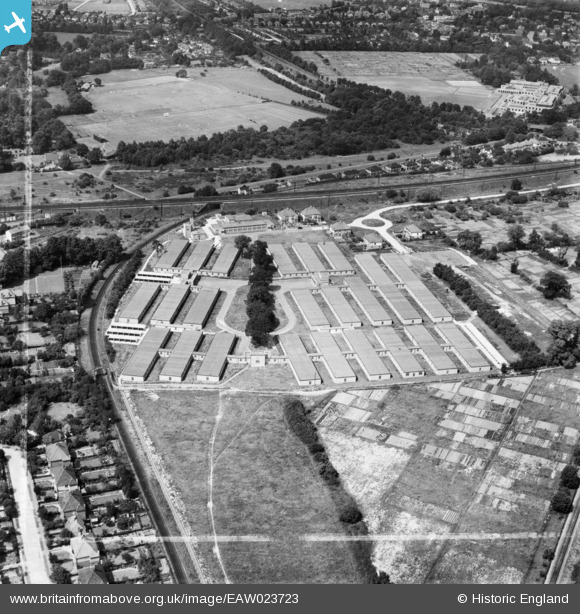
EAW023723 ENGLAND (1949). Government Office Buildings, Hinchley Wood, 1949. This image was marked by Aerofilms Ltd for photo editing.
© Copyright OpenStreetMap contributors and licensed by the OpenStreetMap Foundation. 2026. Cartography is licensed as CC BY-SA.
Nearby Images (7)
EAW023723

EAW023724

EAW023721

EAW023720

EAW023718

EAW023719

EAW023722

Details
| Title | [EAW023723] Government Office Buildings, Hinchley Wood, 1949. This image was marked by Aerofilms Ltd for photo editing. |
| Reference | EAW023723 |
| Date | 12-June-1949 |
| Link | |
| Place name | HINCHLEY WOOD |
| Parish | |
| District | |
| Country | ENGLAND |
| Easting / Northing | 515659, 165787 |
| Longitude / Latitude | -0.33794164169522, 51.378839795943 |
| National Grid Reference | TQ157658 |
Pins

Mr Nozzle |
Sunday 13th of January 2019 06:38:45 PM | |
|
Des |
Wednesday 16th of December 2015 02:49:01 PM | |
|
Des |
Wednesday 16th of December 2015 02:48:14 PM | |
|
Des |
Wednesday 16th of December 2015 02:44:15 PM | |

Jon |
Thursday 28th of May 2015 07:47:36 PM |
User Comment Contributions
The Milk Marketing Board and Giggs Hill Green |
Gina Phillips |
Friday 20th of December 2013 08:18:16 PM |