
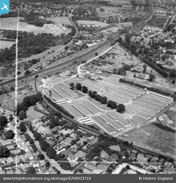
EAW023718 ENGLAND (1949). Government Office Buildings, Hinchley Wood, 1949. This image was marked by Aerofilms Ltd for photo editing.
© Copyright OpenStreetMap contributors and licensed by the OpenStreetMap Foundation. 2026. Cartography is licensed as CC BY-SA.
Nearby Images (7)
EAW023718

EAW023719

EAW023721

EAW023723

EAW023720

EAW023724

EAW023722

Details
| Title | [EAW023718] Government Office Buildings, Hinchley Wood, 1949. This image was marked by Aerofilms Ltd for photo editing. |
| Reference | EAW023718 |
| Date | 12-June-1949 |
| Link | |
| Place name | HINCHLEY WOOD |
| Parish | |
| District | |
| Country | ENGLAND |
| Easting / Northing | 515672, 165838 |
| Longitude / Latitude | -0.33773830244066, 51.379295580782 |
| National Grid Reference | TQ157658 |
Pins

Edmiller |
Saturday 12th of February 2022 02:12:50 AM | |
|
Edmiller |
Saturday 12th of February 2022 02:12:22 AM | |
|
John Wass |
Tuesday 8th of July 2014 08:21:37 PM | |
|
Gina Phillips |
Friday 20th of December 2013 08:44:29 PM | |
|
Gina Phillips |
Friday 20th of December 2013 08:42:18 PM | |
|
Gina Phillips |
Friday 20th of December 2013 08:41:30 PM | |
|
Gina Phillips |
Friday 20th of December 2013 08:40:40 PM | |
|
Gina Phillips |
Friday 20th of December 2013 08:37:45 PM |
User Comment Contributions
A perfect view of multiple flying railway junctions showing both the Hampton Court Junction nearer the top of the image and New Guildford Line Junction nearer the bottom of the image. |

Class31 |
Wednesday 4th of June 2014 01:16:19 PM |
The Angel |
Gina Phillips |
Friday 20th of December 2013 08:39:36 PM |