
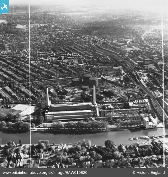
EAW019820 ENGLAND (1948). Kingston Power Station and environs, Kingston Upon Thames, from the west, 1948. This image has been produced from a print marked by Aerofilms Ltd for photo editing.
© Copyright OpenStreetMap contributors and licensed by the OpenStreetMap Foundation. 2026. Cartography is licensed as CC BY-SA.
Nearby Images (9)
EAW019820

EAW019822

EAW019817

EAW019818

EAW019815

EAW019821

EPW053659

EAW019816

EAW019819

Details
| Title | [EAW019820] Kingston Power Station and environs, Kingston Upon Thames, from the west, 1948. This image has been produced from a print marked by Aerofilms Ltd for photo editing. |
| Reference | EAW019820 |
| Date | 18-October-1948 |
| Link | |
| Place name | KINGSTON UPON THAMES |
| Parish | |
| District | |
| Country | ENGLAND |
| Easting / Northing | 517835, 169826 |
| Longitude / Latitude | -0.30534499375785, 51.414697688958 |
| National Grid Reference | TQ178698 |
Pins

UPONTHAMES |
Saturday 28th of September 2024 09:14:22 PM | |
|
UPONTHAMES |
Saturday 28th of September 2024 08:55:30 PM | |
|
UPONTHAMES |
Saturday 28th of September 2024 08:54:57 PM | |
|
UPONTHAMES |
Saturday 28th of September 2024 08:53:00 PM | |
|
UPONTHAMES |
Saturday 28th of September 2024 08:51:00 PM | |
|
UPONTHAMES |
Saturday 28th of September 2024 08:49:20 PM | |
|
UPONTHAMES |
Saturday 28th of September 2024 08:36:59 PM | |
|
UPONTHAMES |
Saturday 28th of September 2024 08:34:54 PM | |
|
UPONTHAMES |
Saturday 28th of September 2024 08:33:04 PM |