
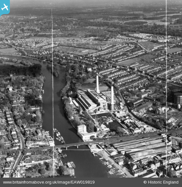
EAW019819 ENGLAND (1948). Kingston Power Station and environs, Kingston Upon Thames, 1948. This image has been produced from a print marked by Aerofilms Ltd for photo editing.
© Copyright OpenStreetMap contributors and licensed by the OpenStreetMap Foundation. 2026. Cartography is licensed as CC BY-SA.
Nearby Images (7)
EAW019819

EAW019816

EAW019818

EAW019817

EAW019820

EPW049569

EAW019822

Details
| Title | [EAW019819] Kingston Power Station and environs, Kingston Upon Thames, 1948. This image has been produced from a print marked by Aerofilms Ltd for photo editing. |
| Reference | EAW019819 |
| Date | 18-October-1948 |
| Link | |
| Place name | KINGSTON UPON THAMES |
| Parish | |
| District | |
| Country | ENGLAND |
| Easting / Northing | 517934, 170032 |
| Longitude / Latitude | -0.3038533417029, 51.416528770964 |
| National Grid Reference | TQ179700 |
Pins

gBr |
Sunday 7th of May 2017 07:07:22 PM | |
|
gBr |
Sunday 7th of May 2017 07:03:58 PM | |
|
gBr |
Sunday 7th of May 2017 07:01:06 PM |