
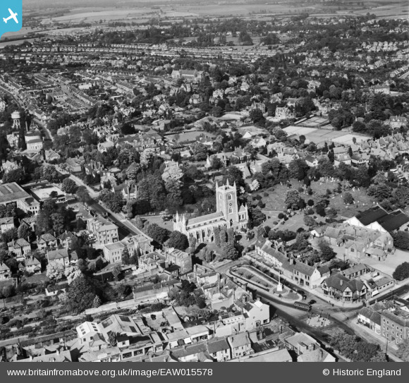
EAW015578 ENGLAND (1948). St Peter's Church and the surrounding residential area, St Albans, 1948
© Copyright OpenStreetMap contributors and licensed by the OpenStreetMap Foundation. 2026. Cartography is licensed as CC BY-SA.
Nearby Images (12)
EAW015578

EAW015579

EAW015580

EPW001252

EPW019247

EAW003449

EAW003451

EAW003450

EPW024300

EAW003452

EAW000661

EPW025387

Details
| Title | [EAW015578] St Peter's Church and the surrounding residential area, St Albans, 1948 |
| Reference | EAW015578 |
| Date | 13-May-1948 |
| Link | |
| Place name | ST ALBANS |
| Parish | |
| District | |
| Country | ENGLAND |
| Easting / Northing | 515110, 207678 |
| Longitude / Latitude | -0.33210251342901, 51.755493754797 |
| National Grid Reference | TL151077 |
Pins
Be the first to add a comment to this image!