
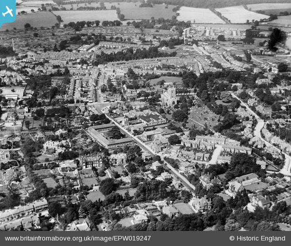
EPW019247 ENGLAND (1927). St Peter's Church and the town, St Albans, 1927
© Copyright OpenStreetMap contributors and licensed by the OpenStreetMap Foundation. 2026. Cartography is licensed as CC BY-SA.
Nearby Images (7)
EPW019247

EAW015580

EAW015579

EAW015578

EPW025387

EPW001252

EPW019238

Details
| Title | [EPW019247] St Peter's Church and the town, St Albans, 1927 |
| Reference | EPW019247 |
| Date | August-1927 |
| Link | |
| Place name | ST ALBANS |
| Parish | |
| District | |
| Country | ENGLAND |
| Easting / Northing | 515052, 207533 |
| Longitude / Latitude | -0.33299052600046, 51.754202369485 |
| National Grid Reference | TL151075 |
Pins
Be the first to add a comment to this image!