
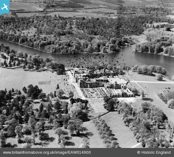
EAW014900 ENGLAND (1948). Blenheim Palace, Woodstock, 1948. This image has been produced from a damaged negative.
© Copyright OpenStreetMap contributors and licensed by the OpenStreetMap Foundation. 2026. Cartography is licensed as CC BY-SA.
Nearby Images (10)
EAW014900

EPW026924

EAW049259

EAW049258

EAW014901

EAW014899

EAW014906

EAW014897

EAW041215
 and Park, Woodstock, from the south, 1951. This image has been produced from a damaged negative.")
EAW014898

Details
| Title | [EAW014900] Blenheim Palace, Woodstock, 1948. This image has been produced from a damaged negative. |
| Reference | EAW014900 |
| Date | 26-April-1948 |
| Link | |
| Place name | WOODSTOCK |
| Parish | BLENHEIM |
| District | |
| Country | ENGLAND |
| Easting / Northing | 444054, 216070 |
| Longitude / Latitude | -1.360483964594, 51.841050378182 |
| National Grid Reference | SP441161 |
Pins
 |

Class31 |
Thursday 30th of April 2015 05:44:41 PM |