
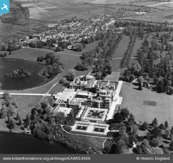
EAW014906 ENGLAND (1948). Blenheim Palace, Woodstock, 1948. This image has been produced from a print.
© Copyright OpenStreetMap contributors and licensed by the OpenStreetMap Foundation. 2026. Cartography is licensed as CC BY-SA.
Nearby Images (7)
EAW014906

EAW014897

EAW049259

EAW014900

EPW026924

EAW014898

EAW014899

Details
| Title | [EAW014906] Blenheim Palace, Woodstock, 1948. This image has been produced from a print. |
| Reference | EAW014906 |
| Date | 26-April-1948 |
| Link | |
| Place name | WOODSTOCK |
| Parish | BLENHEIM |
| District | |
| Country | ENGLAND |
| Easting / Northing | 444183, 216189 |
| Longitude / Latitude | -1.3585962390347, 51.842110162018 |
| National Grid Reference | SP442162 |
Pins
Be the first to add a comment to this image!