
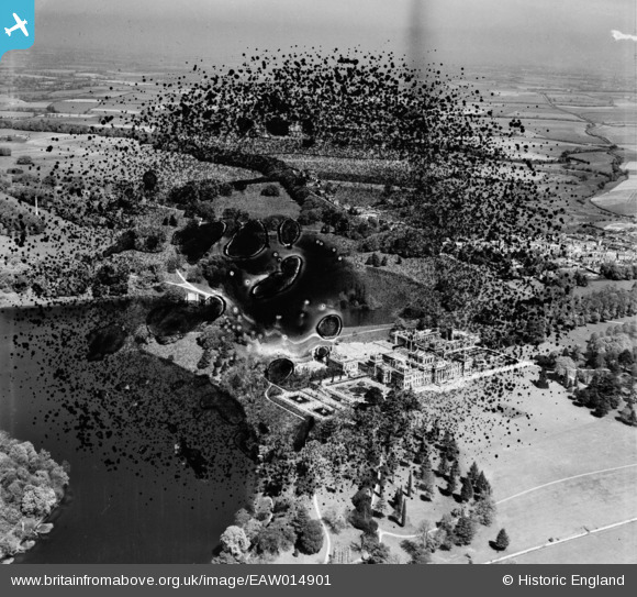
EAW014901 ENGLAND (1948). Blenheim Palace, Woodstock, from the south, 1948. This image has been produced from a damaged negative.
© Copyright OpenStreetMap contributors and licensed by the OpenStreetMap Foundation. 2026. Cartography is licensed as CC BY-SA.
Nearby Images (8)
EAW014901

EAW041215
 and Park, Woodstock, from the south, 1951. This image has been produced from a damaged negative.")
EPW026924

EAW014900

EAW049258

EAW014899

EAW041214

EAW049259

Details
| Title | [EAW014901] Blenheim Palace, Woodstock, from the south, 1948. This image has been produced from a damaged negative. |
| Reference | EAW014901 |
| Date | 26-April-1948 |
| Link | |
| Place name | WOODSTOCK |
| Parish | BLENHEIM |
| District | |
| Country | ENGLAND |
| Easting / Northing | 444002, 215939 |
| Longitude / Latitude | -1.3612554484084, 51.839876602654 |
| National Grid Reference | SP440159 |
Pins
Be the first to add a comment to this image!