
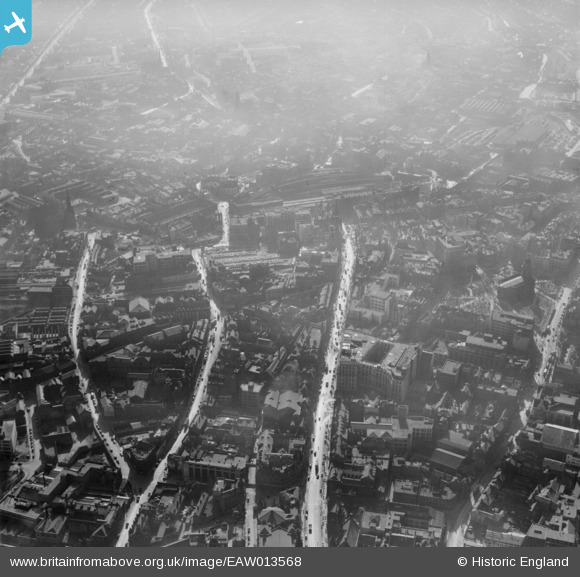
EAW013568 ENGLAND (1948). The city centre including High Street and Corporation Street, Birmingham, 1948
© Copyright OpenStreetMap contributors and licensed by the OpenStreetMap Foundation. 2026. Cartography is licensed as CC BY-SA.
Nearby Images (29)
EAW013568

EPW048093

EAW013567

EAW001238

EPW057481

EAW013573

EAW013572

EAW026255

EAW035107

EAW001235

EAW015327

EAW013571

EAW001237

EPW053091

EAW026254

EAW001239

EAW035108

EAW036926

EAW036921

EAW036918

EAW029414

EAW036925

EPW038601

EAW029415

EAW036924

EPW058129

EPW005840

EPW022586

EPW005842

Details
| Title | [EAW013568] The city centre including High Street and Corporation Street, Birmingham, 1948 |
| Reference | EAW013568 |
| Date | 9-March-1948 |
| Link | |
| Place name | BIRMINGHAM |
| Parish | |
| District | |
| Country | ENGLAND |
| Easting / Northing | 407149, 286863 |
| Longitude / Latitude | -1.8947258986697, 52.479276752947 |
| National Grid Reference | SP071869 |


