
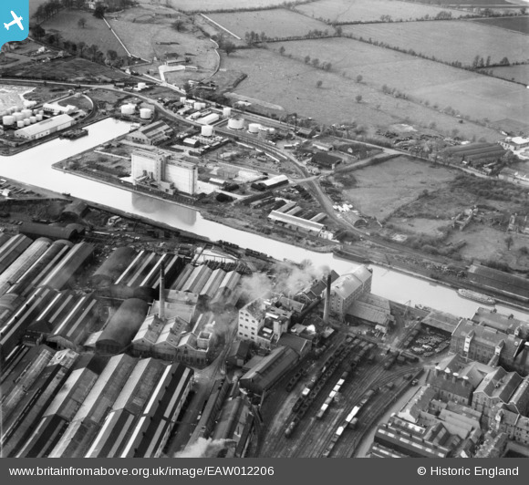
EAW012206 ENGLAND (1947). Gloucester Docks and the surrounding industrial area, Gloucester, 1947
© Copyright OpenStreetMap contributors and licensed by the OpenStreetMap Foundation. 2026. Cartography is licensed as CC BY-SA.
Nearby Images (27)
EAW012206

EAW012208

EPW037836

EAW012198

EAW012199

EPW016966

EPW048240

EAW012196

EAW032298

EAW032297

EAW012201

EAW032302

EAW032299

EAW032294

EAW032295

EAW032301

EAW032296

EAW012205

EPW037770

EAW032293

EAW012203

EPW048245

EPW024167

EPW038346

EPW038348

EPW038347

EPW038345

Details
| Title | [EAW012206] Gloucester Docks and the surrounding industrial area, Gloucester, 1947 |
| Reference | EAW012206 |
| Date | 13-November-1947 |
| Link | |
| Place name | GLOUCESTER |
| Parish | |
| District | |
| Country | ENGLAND |
| Easting / Northing | 382433, 217788 |
| Longitude / Latitude | -2.2551083428264, 51.857960349815 |
| National Grid Reference | SO824178 |
Pins
Be the first to add a comment to this image!