
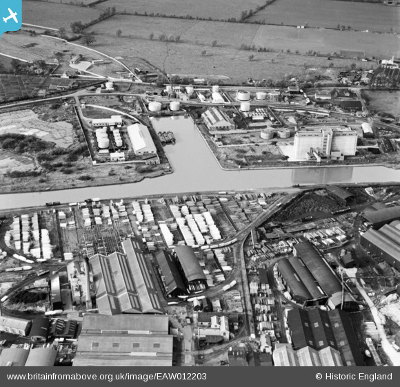
EAW012203 ENGLAND (1947). Monk Meadow Dock and the surrounding industrial area, Gloucester, 1947
© Copyright OpenStreetMap contributors and licensed by the OpenStreetMap Foundation. 2026. Cartography is licensed as CC BY-SA.
Nearby Images (15)
EAW012203

EPW048245

EAW012201

EPW024167

EPW037771

EPW016966

EPW037770

EAW012205

EPW037769

EAW032302

EAW012199

EAW032297

EAW012206

EAW012208

EAW032298

Details
| Title | [EAW012203] Monk Meadow Dock and the surrounding industrial area, Gloucester, 1947 |
| Reference | EAW012203 |
| Date | 13-November-1947 |
| Link | |
| Place name | GLOUCESTER |
| Parish | |
| District | |
| Country | ENGLAND |
| Easting / Northing | 382363, 217560 |
| Longitude / Latitude | -2.2561132333726, 51.855907995015 |
| National Grid Reference | SO824176 |
