
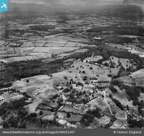
EAW001467 ENGLAND (1946). The village and surrounding countryside, Frant, from the south-west, 1946
© Copyright OpenStreetMap contributors and licensed by the OpenStreetMap Foundation. 2026. Cartography is licensed as CC BY-SA.
Nearby Images (11)
EAW001467

EPW028554

EPW028549

EAW001468

EPW028553

EAW003546

EAW002295

EAW002294

EAW001466

EPW028552

EPW050336

Details
| Title | [EAW001467] The village and surrounding countryside, Frant, from the south-west, 1946 |
| Reference | EAW001467 |
| Date | 3-July-1946 |
| Link | |
| Place name | FRANT |
| Parish | FRANT |
| District | |
| Country | ENGLAND |
| Easting / Northing | 559040, 135666 |
| Longitude / Latitude | 0.27162418405033, 51.097682794866 |
| National Grid Reference | TQ590357 |
Pins

Sparky |
Saturday 23rd of September 2017 10:01:36 AM |