
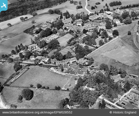
EPW028552 ENGLAND (1929). Frant Court and the village, Frant, 1929
© Copyright OpenStreetMap contributors and licensed by the OpenStreetMap Foundation. 2026. Cartography is licensed as CC BY-SA.
Nearby Images (9)
EPW028552

EPW028553

EAW001466

EPW028549

EPW028554

EAW003099

EAW001467

EAW003102

EAW003101

Details
| Title | [EPW028552] Frant Court and the village, Frant, 1929 |
| Reference | EPW028552 |
| Date | August-1929 |
| Link | |
| Place name | FRANT |
| Parish | FRANT |
| District | |
| Country | ENGLAND |
| Easting / Northing | 558916, 135459 |
| Longitude / Latitude | 0.26976341689831, 51.095857064248 |
| National Grid Reference | TQ589355 |
Pins
Be the first to add a comment to this image!