Skip to main content
Prydain oddi Fry
Cymraeg
|
English
Mewngofnod
|
Cofrestru
Toggle navigation
Hafan
Gwaddol
Ynghylch
Map
Orielau
Grwpiau
Cymorth
Chwilio
Pob Gwlad (96344)
Lloegr (82521)
Yr Alban (6398)
Cymru (4321)
Gweddill y Byd (3104)
Gwlad Belg (7)
Ffrainc (27)
yr Almaen (2)
Guernsey (116)
Iran (8)
Irac (6)
Iwerddon (1466)
Ynys Manaw (75)
Jersey (122)
yr Iseldiroedd (20)
Northern Ireland (1163)
Sbaen (9)
y Swisdir (26)
Gweithgaredd Diweddaraf
Saved Images
Pagination
First page
first
Previous page
previous
…
Tudalen
120
Tudalen
121
Tudalen
122
Tudalen
123
Current page
124
Tudalen
125
Tudalen
126
Tudalen
127
Tudalen
128
…
Next page
next
Last page
last
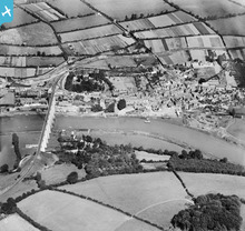
[EPW023619] The village and railway viaduct over the River Tamar, Calstock, 1928
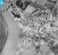
[EPW023618] The village centre, Calstock, 1928
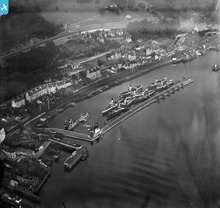
[SPW019472] Bowling Harbour, River Clyde, showing The Iona and The Columba. An oblique aerial photograph taken facing north-east.
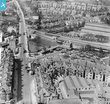
[EPW000810] Golders Green Station, Golders Green, 1920
[EPW001755] Vicarage Road area and the Cambridge and Newmarket railway, Newmarket, 1920
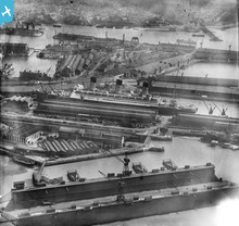
[EPW020455] The Docks, Floating Dock and RMS Berengaria, Southampton, 1928
[EPW000322] Ocean Dock, Inner Dock and Outer Dock, Southampton, from the west, 1920
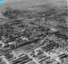
[SPW050832] Glasgow, general view, showing Meadowside Granary and Upper Clyde Shipbuilding Yard. An oblique aerial photograph taken facing north.
Pagination
First page
first
Previous page
previous
…
Tudalen
120
Tudalen
121
Tudalen
122
Tudalen
123
Current page
124
Tudalen
125
Tudalen
126
Tudalen
127
Tudalen
128
…
Next page
next
Last page
last
This user has had no activity in the last year.