
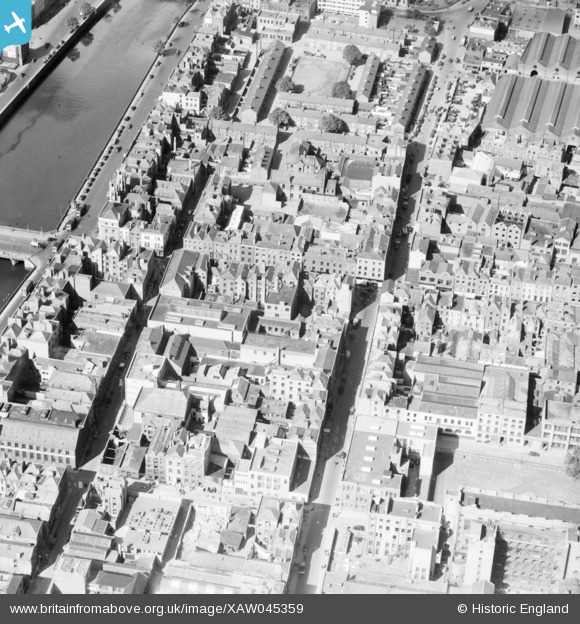
XAW045359 IRELAND (1952). Leethams (Ireland) Ltd., Upper Abbey Street, Dublin, Dublin, Ireland, 1952. Oblique aerial photograph taken facing West.
© Hawlfraint cyfranwyr OpenStreetMap a thrwyddedwyd gan yr OpenStreetMap Foundation. 2026. Trwyddedir y gartograffeg fel CC BY-SA.
Delweddau cyfagos (14)
XAW045359
 Ltd., Upper Abbey Street, Dublin, Dublin, Ireland, 1952. Oblique aerial photograph taken facing West.")
XAW045360
 Ltd., Upper Abbey Street, Dublin, Dublin, Ireland, 1952. Oblique aerial photograph taken facing West.")
XAW045354
 Ltd., Upper Abbey Street, Dublin, Dublin, Ireland, 1952. Oblique aerial photograph taken facing South.")
XPW043444

XAW045353
 Ltd., Upper Abbey Street, Dublin, Dublin, Ireland, 1952. Oblique aerial photograph taken facing North/West.")
XAW045357
 Ltd., Upper Abbey Street, Dublin, Dublin, Ireland, 1952. Oblique aerial photograph taken facing North/West.")
XAW045356
 Ltd., Upper Abbey Street, Dublin, Dublin, Ireland, 1952. Oblique aerial photograph taken facing South.")
XPW042325

XAW045355
 Ltd., Upper Abbey Street, Dublin, Dublin, Ireland, 1952. Oblique aerial photograph taken facing North/West.")
XAW045358
 Ltd., Upper Abbey Street, Dublin, Dublin, Ireland, 1952. Oblique aerial photograph taken facing North/West.")
XAW044976

XPW043437

XAW052122

XAW044978

Manylion
| Pennawd | [XAW045359] Leethams (Ireland) Ltd., Upper Abbey Street, Dublin, Dublin, Ireland, 1952. Oblique aerial photograph taken facing West. |
| Cyfeirnod | XAW045359 |
| Dyddiad | 15-July-1952 |
| Dolen | |
| Enw lle | DUBLIN |
| Plwyf | IRELAND |
| Ardal | |
| Gwlad | IRELAND |
| Dwyreiniad / Gogleddiad | 116003, 391864 |
| Hydred / Lledred | -6.268553, 53.347196 |
| Cyfeirnod Grid Cenedlaethol |
