
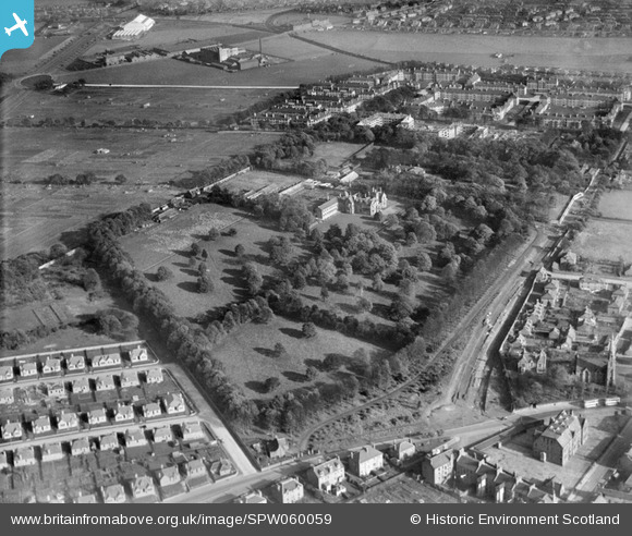
SPW060059 SCOTLAND (1938). Florence Booth House, Clement Park, Lochee, Dundee. An oblique aerial photograph taken facing east.
© Hawlfraint cyfranwyr OpenStreetMap a thrwyddedwyd gan yr OpenStreetMap Foundation. 2026. Trwyddedir y gartograffeg fel CC BY-SA.
Delweddau cyfagos (8)
SPW060059

SPW060060

SPW060061

SPW060062

SPW060055

SPW060056

SPW060057

SPW060058

Manylion
| Pennawd | [SPW060059] Florence Booth House, Clement Park, Lochee, Dundee. An oblique aerial photograph taken facing east. |
| Cyfeirnod | SPW060059 |
| Dyddiad | 1938 |
| Dolen | NRHE Collection item 1259521 |
| Enw lle | |
| Plwyf | DUNDEE (DUNDEE, CITY OF) |
| Ardal | CITY OF DUNDEE |
| Gwlad | SCOTLAND |
| Dwyreiniad / Gogleddiad | 337965, 732053 |
| Hydred / Lledred | -3.0072105424898, 56.476608519947 |
| Cyfeirnod Grid Cenedlaethol | NO380321 |
Pinnau
Byddwch y cyntaf i ychwanegu sylw at y ddelwedd hon!