
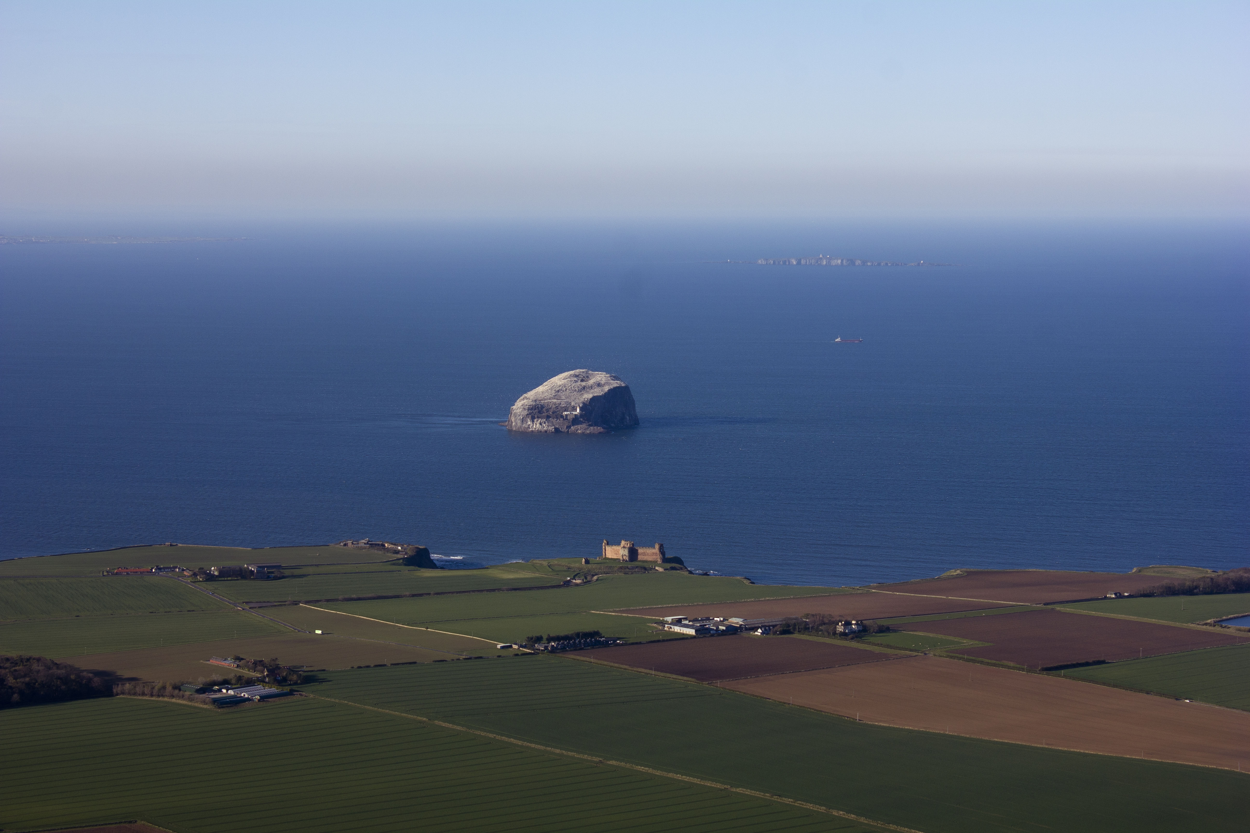
SPW027373 SCOTLAND (1929). Tantallon Castle and Bass Rock. An oblique aerial photograph taken facing north. This image has been produced from a marked print.

© Hawlfraint cyfranwyr OpenStreetMap a thrwyddedwyd gan yr OpenStreetMap Foundation. 2026. Trwyddedir y gartograffeg fel CC BY-SA.
Delweddau cyfagos (4)
SAW046299

SAW046300

SPW027373

SAW052507

Manylion
| Pennawd | [SPW027373] Tantallon Castle and Bass Rock. An oblique aerial photograph taken facing north. This image has been produced from a marked print. |
| Cyfeirnod | SPW027373 |
| Dyddiad | 1929 |
| Dolen | NRHE Collection item 1315461 |
| Enw lle | |
| Plwyf | NORTH BERWICK |
| Ardal | EAST LOTHIAN |
| Gwlad | SCOTLAND |
| Dwyreiniad / Gogleddiad | 359523, 685000 |
| Hydred / Lledred | -2.6500162299033, 56.056193471913 |
| Cyfeirnod Grid Cenedlaethol | NT595850 |
Pinnau
Byddwch y cyntaf i ychwanegu sylw at y ddelwedd hon!
Cyfraniadau Grŵp
85 years on and the field boundaries are still mostly in the same places. So much changes in the landscape but so much stays the same... (Picture added from April 2014). |

swopiv |
Thursday 26th of May 2016 11:59:14 AM |