
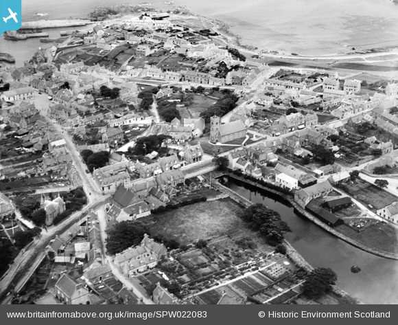
SPW022083 SCOTLAND (1928). Portsoy, general view, showing Church Hall, Station Hotel and Loch of Soy. An oblique aerial photograph taken facing north-east.
© Hawlfraint cyfranwyr OpenStreetMap a thrwyddedwyd gan yr OpenStreetMap Foundation. 2026. Trwyddedir y gartograffeg fel CC BY-SA.
Delweddau cyfagos (3)
SPW022083

SAR033576

SPW022081

Manylion
| Pennawd | [SPW022083] Portsoy, general view, showing Church Hall, Station Hotel and Loch of Soy. An oblique aerial photograph taken facing north-east. |
| Cyfeirnod | SPW022083 |
| Dyddiad | 1928 |
| Dolen | NRHE Collection item 1256461 |
| Enw lle | |
| Plwyf | FORDYCE |
| Ardal | BANFF AND BUCHAN |
| Gwlad | SCOTLAND |
| Dwyreiniad / Gogleddiad | 358938, 865974 |
| Hydred / Lledred | -2.6886603322734, 57.681989793917 |
| Cyfeirnod Grid Cenedlaethol | NJ589660 |
Pinnau
Byddwch y cyntaf i ychwanegu sylw at y ddelwedd hon!