
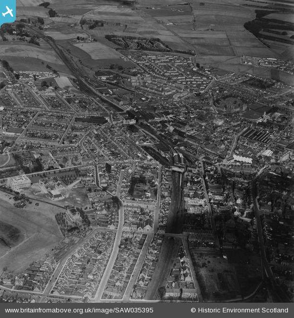
SAW035395 SCOTLAND (1951). Arbroath, general view. An oblique aerial photograph taken facing north. This image has been produced from a print.
© Hawlfraint cyfranwyr OpenStreetMap a thrwyddedwyd gan yr OpenStreetMap Foundation. 2026. Trwyddedir y gartograffeg fel CC BY-SA.
Delweddau cyfagos (3)
SAW035395

SAW035394

SAW035396

Manylion
| Pennawd | [SAW035395] Arbroath, general view. An oblique aerial photograph taken facing north. This image has been produced from a print. |
| Cyfeirnod | SAW035395 |
| Dyddiad | 1951 |
| Dolen | NRHE Collection item 1315221 |
| Enw lle | |
| Plwyf | ARBROATH AND ST VIGEANS |
| Ardal | ANGUS |
| Gwlad | SCOTLAND |
| Dwyreiniad / Gogleddiad | 363880, 741080 |
| Hydred / Lledred | -2.5877381950944, 56.560411425186 |
| Cyfeirnod Grid Cenedlaethol | NO639411 |
Pinnau

Post-war prefabs |
Thursday 6th of February 2020 01:29:58 PM |