
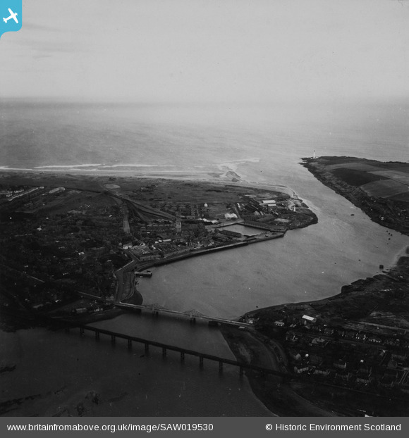
SAW019530 SCOTLAND (1948). Montrose, general view, showing Montrose Harbour and Scurdie Ness. An oblique aerial photograph taken facing east. This image has been produced from a print.
© Hawlfraint cyfranwyr OpenStreetMap a thrwyddedwyd gan yr OpenStreetMap Foundation. 2026. Trwyddedir y gartograffeg fel CC BY-SA.
Delweddau cyfagos (2)
SAW019530

SAR036015

Manylion
| Pennawd | [SAW019530] Montrose, general view, showing Montrose Harbour and Scurdie Ness. An oblique aerial photograph taken facing east. This image has been produced from a print. |
| Cyfeirnod | SAW019530 |
| Dyddiad | 1948 |
| Dolen | NRHE Collection item 1314918 |
| Enw lle | |
| Plwyf | MONTROSE |
| Ardal | ANGUS |
| Gwlad | SCOTLAND |
| Dwyreiniad / Gogleddiad | 371864, 757196 |
| Hydred / Lledred | -2.4595860800795, 56.705752422283 |
| Cyfeirnod Grid Cenedlaethol | NO719572 |
Pinnau

cptpies |
Monday 9th of December 2013 09:39:17 AM |
Cyfraniadau Grŵp

Coast Artillery Battery, Montrose. |
cptpies |
Thursday 19th of December 2013 02:38:55 PM |