
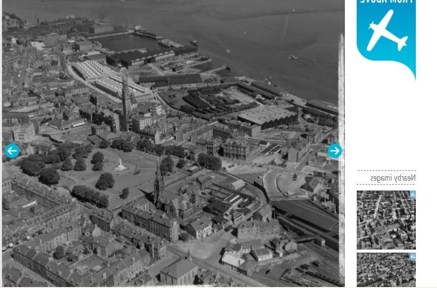
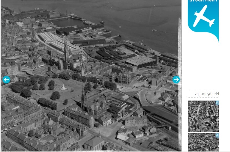
SAR018766 SCOTLAND (1953). General View Greenock, Renfrewshire, Scotland. An oblique aerial photograph taken facing North/East. This image was marked by AeroPictorial Ltd for photo editing.

© Hawlfraint cyfranwyr OpenStreetMap a thrwyddedwyd gan yr OpenStreetMap Foundation. 2026. Trwyddedir y gartograffeg fel CC BY-SA.
Delweddau cyfagos (11)
SAR018766

SAW032142

SAW032143

SAW032146

SAW009823

SAW032139

SAW032141

SAW032144

SAW032145

SAW009810

SAW032140

Manylion
| Pennawd | [SAR018766] General View Greenock, Renfrewshire, Scotland. An oblique aerial photograph taken facing North/East. This image was marked by AeroPictorial Ltd for photo editing. |
| Cyfeirnod | SAR018766 |
| Dyddiad | 1953 |
| Dolen | NRHE Collection item 1438081 |
| Enw lle | |
| Plwyf | GREENOCK |
| Ardal | INVERCLYDE |
| Gwlad | SCOTLAND |
| Dwyreiniad / Gogleddiad | 227610, 676260 |
| Hydred / Lledred | -4.761077377206, 55.948435423517 |
| Cyfeirnod Grid Cenedlaethol | NS276763 |
Pinnau
Cyfraniadau Grŵp
This photo is round the wrong way...would be good if it could be fixed |

angela |
Monday 6th of October 2014 04:07:35 PM |
This image is the wrong way around |
Elliott |
Monday 6th of October 2014 04:03:59 PM |
Yes i agree. |
Tommy |
Monday 6th of October 2014 04:03:59 PM |
This image is the wrong way round ie: it is a mirrored version I have attached a corrected version. |
Tommy |
Monday 6th of October 2014 04:02:12 PM |