
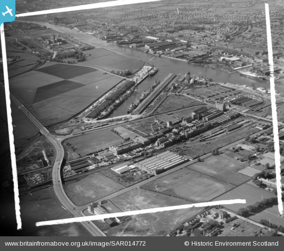
SAR014772 SCOTLAND (1951). Shieldhall and King George V Dock from North side of River Govan, Lanarkshire, Scotland. An oblique aerial photograph taken facing North. This image was marked by AeroPictorial Ltd for photo editing.
© Hawlfraint cyfranwyr OpenStreetMap a thrwyddedwyd gan yr OpenStreetMap Foundation. 2026. Trwyddedir y gartograffeg fel CC BY-SA.
Delweddau cyfagos (11)
SAR014715

SAR014716

SAR014723

SAR014772

SAR014773

SAR014775

SAR014783

SPW020702

SPW020703

SPW045892

SPW050837

Manylion
| Pennawd | [SAR014772] Shieldhall and King George V Dock from North side of River Govan, Lanarkshire, Scotland. An oblique aerial photograph taken facing North. This image was marked by AeroPictorial Ltd for photo editing. |
| Cyfeirnod | SAR014772 |
| Dyddiad | 1951 |
| Dolen | NRHE Collection item 1437875 |
| Enw lle | |
| Plwyf | GOVAN (CITY OF GLASGOW) |
| Ardal | CITY OF GLASGOW |
| Gwlad | SCOTLAND |
| Dwyreiniad / Gogleddiad | 252891, 666503 |
| Hydred / Lledred | -4.3512734125986, 55.869237782579 |
| Cyfeirnod Grid Cenedlaethol | NS529665 |
Pinnau
Byddwch y cyntaf i ychwanegu sylw at y ddelwedd hon!