
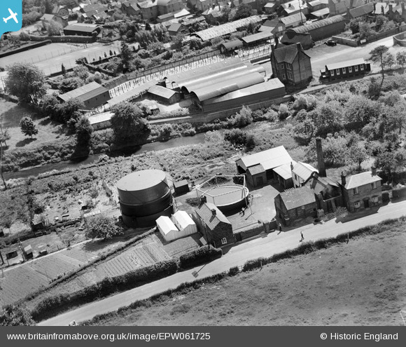
EPW061725 ENGLAND (1939). Tenbury Cattle Market and the Gas Works, Burford, 1939
© Hawlfraint cyfranwyr OpenStreetMap a thrwyddedwyd gan yr OpenStreetMap Foundation. 2026. Trwyddedir y gartograffeg fel CC BY-SA.
Delweddau cyfagos (9)
EPW061725

EPW061727

EPW061726

EPW061723

EPW061724

EPW061939

EAW029810

EAW029805

EPW061938

Manylion
| Pennawd | [EPW061725] Tenbury Cattle Market and the Gas Works, Burford, 1939 |
| Cyfeirnod | EPW061725 |
| Dyddiad | 10-June-1939 |
| Dolen | |
| Enw lle | BURFORD |
| Plwyf | BURFORD |
| Ardal | |
| Gwlad | ENGLAND |
| Dwyreiniad / Gogleddiad | 359707, 268578 |
| Hydred / Lledred | -2.5911255748654, 52.313441724446 |
| Cyfeirnod Grid Cenedlaethol | SO597686 |
Pinnau

Oliver Romain |
Thursday 17th of October 2013 11:21:22 PM | |

Class31 |
Sunday 25th of August 2013 10:09:51 AM | |
|
Class31 |
Sunday 25th of August 2013 09:41:33 AM | |
|
Class31 |
Sunday 25th of August 2013 09:08:35 AM | |
|
Class31 |
Sunday 25th of August 2013 08:43:59 AM |
Cyfraniadau Grŵp
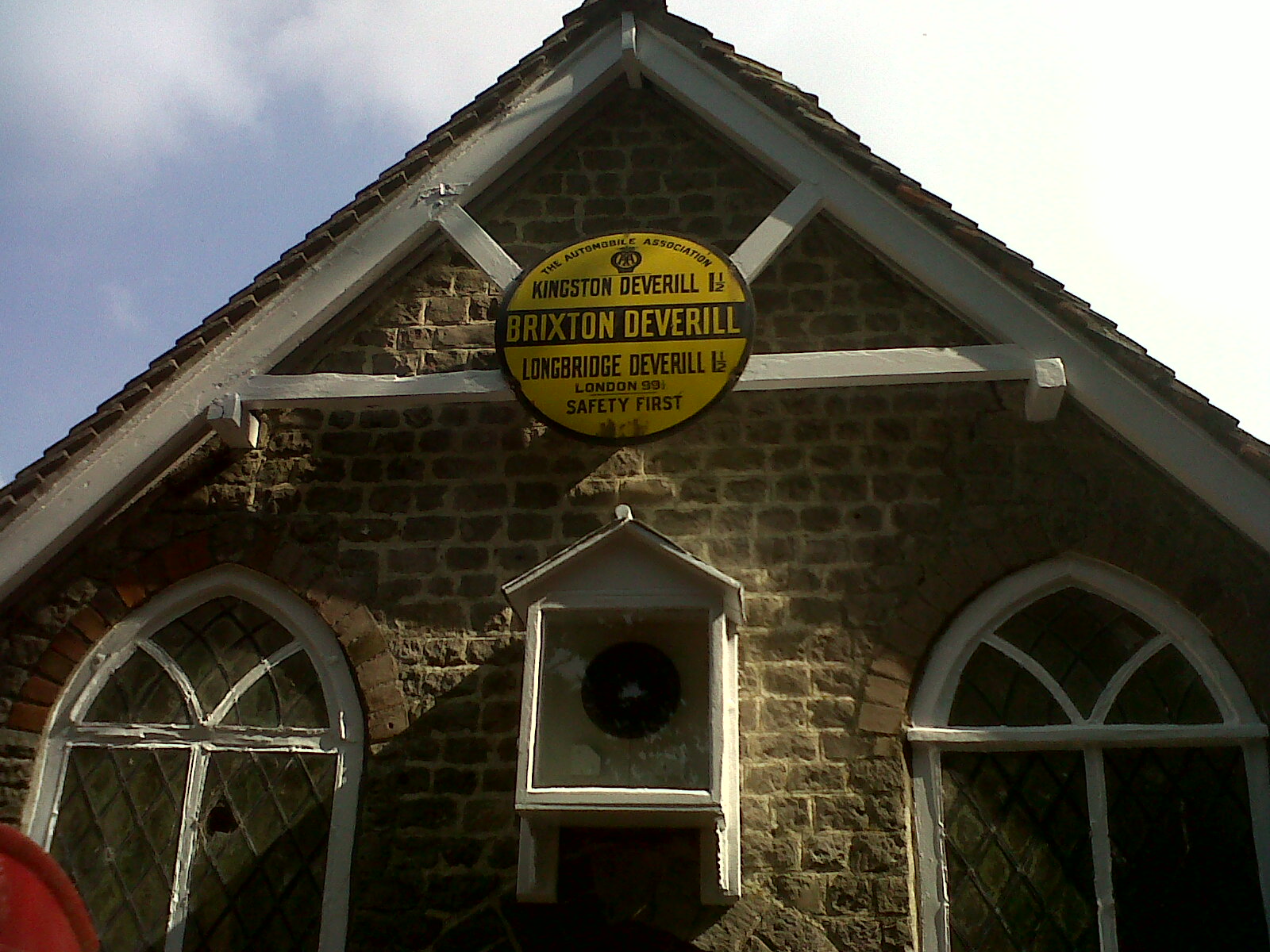
An example of an AA Place name and distance sign on display in Wiltshire showing the standard layout. |
Class31 |
Tuesday 3rd of September 2013 05:14:52 PM |
There are said to be around 65 village signs still in use today. |
Class31 |
Tuesday 3rd of September 2013 05:14:52 PM |
Eureka I was able to make out a letter on the sign. The name started with the letter T. I made a leap and guessed Tenbury Wells which fits this series of photos. |
Class31 |
Tuesday 3rd of September 2013 05:00:10 PM |
Thanks for the location Class31. We'll update the catalogue and post your new data here in due course. Yours, Katy Britain from Above Cataloguing Team Leader |
Katy Whitaker |
Tuesday 3rd of September 2013 05:00:10 PM |
View looking south. |
Class31 |
Sunday 25th of August 2013 12:18:49 PM |
EPW061723 to EPW061727 are a group of the Tenbury Wells gas works. All were taken on 10th June 1939 on a beautiful summer's day. Who would have guessed that within three months the country would be entering into another bloody war only a generation after the war to end all wars. |
Class31 |
Sunday 25th of August 2013 09:59:43 AM |