
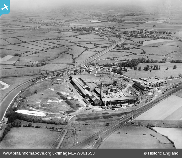
EPW061653 ENGLAND (1939). The Pilkington Brothers Doncaster Glass Works, Kirk Sandall, from the south, 1939
© Hawlfraint cyfranwyr OpenStreetMap a thrwyddedwyd gan yr OpenStreetMap Foundation. 2026. Trwyddedir y gartograffeg fel CC BY-SA.
Delweddau cyfagos (17)
EPW061653

EPW048707

EPW061664

EPW061663

EPW061659

EPW061660

EPW061657

EPW048713

EPW061654

EPW048711

EPW048702

EPW048704

EPW061652

EPW048712

EPW048709

EPW048710

EPW048706

Manylion
| Pennawd | [EPW061653] The Pilkington Brothers Doncaster Glass Works, Kirk Sandall, from the south, 1939 |
| Cyfeirnod | EPW061653 |
| Dyddiad | 6-June-1939 |
| Dolen | |
| Enw lle | KIRK SANDALL |
| Plwyf | BARNBY DUN WITH KIRK SANDALL |
| Ardal | |
| Gwlad | ENGLAND |
| Dwyreiniad / Gogleddiad | 460771, 407537 |
| Hydred / Lledred | -1.0824322796658, 53.560685987767 |
| Cyfeirnod Grid Cenedlaethol | SE608075 |
Pinnau
Byddwch y cyntaf i ychwanegu sylw at y ddelwedd hon!