
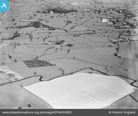
EPW060832 ENGLAND (1939). Fields around Brook House and the River Trent, Barlaston, 1939
© Hawlfraint cyfranwyr OpenStreetMap a thrwyddedwyd gan yr OpenStreetMap Foundation. 2026. Trwyddedir y gartograffeg fel CC BY-SA.
Delweddau cyfagos (7)
EPW060832

EPW060830

EPW060836

EPW060834

EPW060837

EPW060833

EPW060835

Manylion
| Pennawd | [EPW060832] Fields around Brook House and the River Trent, Barlaston, 1939 |
| Cyfeirnod | EPW060832 |
| Dyddiad | April-1939 |
| Dolen | |
| Enw lle | BARLASTON |
| Plwyf | BARLASTON |
| Ardal | |
| Gwlad | ENGLAND |
| Dwyreiniad / Gogleddiad | 388161, 338794 |
| Hydred / Lledred | -2.1762085295928, 52.946086600538 |
| Cyfeirnod Grid Cenedlaethol | SJ882388 |
Pinnau

bescotbeast |
Tuesday 10th of December 2013 08:59:42 PM |
Cyfraniadau Grŵp
Barlaston and Tittensor signal box, NSR Type 1 design. Just about visible on the right hand edge of the picture |
bescotbeast |
Tuesday 10th of December 2013 09:01:53 PM |