
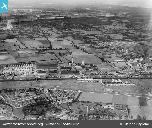
EPW058332 ENGLAND (1938). The Slough Trading Estate and the surrounding area, Slough, 1938
© Hawlfraint cyfranwyr OpenStreetMap a thrwyddedwyd gan yr OpenStreetMap Foundation. 2026. Trwyddedir y gartograffeg fel CC BY-SA.
Delweddau cyfagos (4)
EPW058332

EAW029471

EPW000019

EPW025643

Manylion
| Pennawd | [EPW058332] The Slough Trading Estate and the surrounding area, Slough, 1938 |
| Cyfeirnod | EPW058332 |
| Dyddiad | 28-July-1938 |
| Dolen | |
| Enw lle | SLOUGH |
| Plwyf | |
| Ardal | |
| Gwlad | ENGLAND |
| Dwyreiniad / Gogleddiad | 495081, 180824 |
| Hydred / Lledred | -0.62951215065504, 51.517843367452 |
| Cyfeirnod Grid Cenedlaethol | SU951808 |
Pinnau

Paul |
Tuesday 16th of February 2021 03:08:36 PM | |
|
nikksie |
Wednesday 2nd of March 2016 03:58:14 PM | |
|
payitforwardeddie |
Sunday 23rd of February 2014 04:25:58 PM | |
|
payitforwardeddie |
Sunday 23rd of February 2014 04:24:33 PM | |
|
payitforwardeddie |
Sunday 2nd of February 2014 06:47:45 PM | |
|
payitforwardeddie |
Thursday 12th of December 2013 08:38:33 PM | |
|
dave43 |
Thursday 20th of June 2013 10:31:35 PM | |
|
dave43 |
Thursday 20th of June 2013 10:28:10 PM | |
|
dave43 |
Thursday 20th of June 2013 10:24:48 PM | |
|
dave43 |
Thursday 20th of June 2013 10:24:04 PM | |
|
dave43 |
Thursday 20th of June 2013 10:21:12 PM | |
|
dave43 |
Thursday 20th of June 2013 10:17:15 PM | |
|
dave43 |
Thursday 20th of June 2013 10:16:24 PM | |
|
dave43 |
Thursday 20th of June 2013 10:15:17 PM | |
|
dave43 |
Thursday 20th of June 2013 10:13:25 PM |