
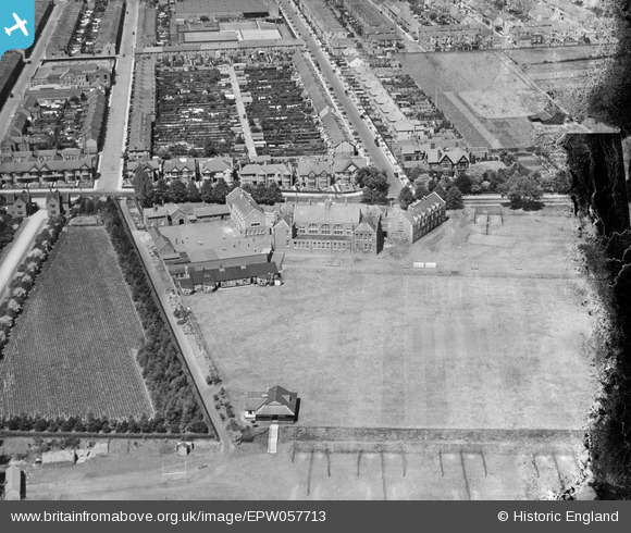
EPW057713 ENGLAND (1938). The Northampton Town and County School (Northampton School for Boys), Northampton, 1938. This image has been produced from a damaged negative.
© Hawlfraint cyfranwyr OpenStreetMap a thrwyddedwyd gan yr OpenStreetMap Foundation. 2026. Trwyddedir y gartograffeg fel CC BY-SA.
Delweddau cyfagos (6)
EPW057713
, Northampton, 1938. This image has been produced from a damaged negative.")
EPW057709
 and playing fields and the surrounding residential area, Northampton, 1938")
EPW057711
 and playing fields, Northampton, 1938")
EPW057710
 and playing fields, Northampton, 1938. This image has been produced from a damaged negative.")
EPW057712
 and playing fields, Northampton, 1938")
EPW057714
 and playing fields, Northampton, 1938. This image has been produced from a damaged negative.")
Manylion
| Pennawd | [EPW057713] The Northampton Town and County School (Northampton School for Boys), Northampton, 1938. This image has been produced from a damaged negative. |
| Cyfeirnod | EPW057713 |
| Dyddiad | 21-June-1938 |
| Dolen | |
| Enw lle | NORTHAMPTON |
| Plwyf | |
| Ardal | |
| Gwlad | ENGLAND |
| Dwyreiniad / Gogleddiad | 477444, 260693 |
| Hydred / Lledred | -0.8657434636333, 52.238574953286 |
| Cyfeirnod Grid Cenedlaethol | SP774607 |
Pinnau
Byddwch y cyntaf i ychwanegu sylw at y ddelwedd hon!