
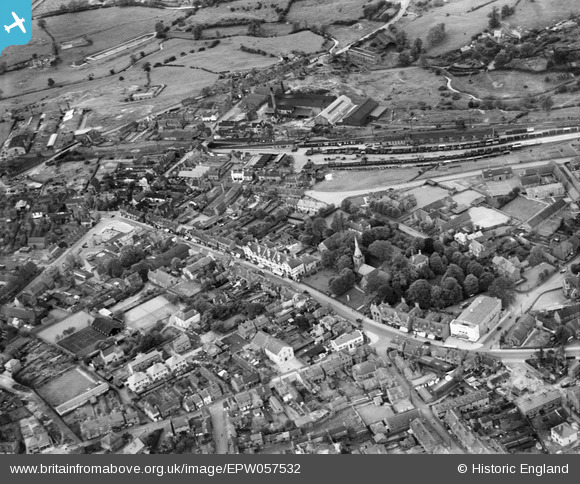
EPW057532 ENGLAND (1938). The High Street, Lye Railway Station and environs, Lye, 1938
© Hawlfraint cyfranwyr OpenStreetMap a thrwyddedwyd gan yr OpenStreetMap Foundation. 2026. Trwyddedir y gartograffeg fel CC BY-SA.
Delweddau cyfagos (2)
EPW057532

EPW057533

Manylion
| Pennawd | [EPW057532] The High Street, Lye Railway Station and environs, Lye, 1938 |
| Cyfeirnod | EPW057532 |
| Dyddiad | 9-June-1938 |
| Dolen | |
| Enw lle | LYE |
| Plwyf | |
| Ardal | |
| Gwlad | ENGLAND |
| Dwyreiniad / Gogleddiad | 392281, 284485 |
| Hydred / Lledred | -2.1136126737906, 52.457888371347 |
| Cyfeirnod Grid Cenedlaethol | SO923845 |
Pinnau

Grisel |
Thursday 3rd of September 2020 12:56:25 PM | |
|
peter stuart legat |
Sunday 5th of July 2020 04:26:44 PM | |
|
John E C |
Wednesday 29th of January 2020 12:23:24 PM | |
|
mark |
Tuesday 28th of November 2017 08:51:28 PM | |
|
Geri |
Friday 3rd of November 2017 07:01:38 PM | |
|
reg instone |
Saturday 21st of February 2015 02:22:32 AM | |
|
reg instone |
Saturday 21st of February 2015 02:21:41 AM | |
|
reg instone |
Saturday 21st of February 2015 02:20:23 AM | |
|
designking |
Saturday 4th of October 2014 09:26:20 PM | |
|
designking |
Saturday 4th of October 2014 09:12:40 PM | |
|
designking |
Saturday 4th of October 2014 09:09:05 PM | |
|
Phil Stoneley |
Monday 27th of January 2014 02:54:06 AM |