
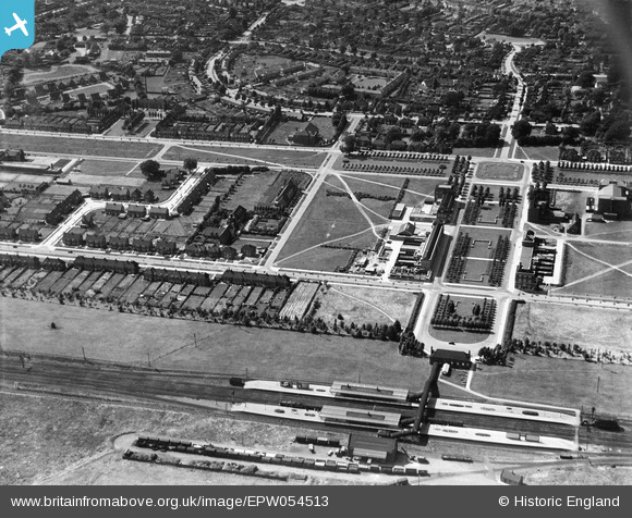
EPW054513 ENGLAND (1937). The Railway Station, Howardsgate and Church Road, Welwyn Garden City, 1937
© Hawlfraint cyfranwyr OpenStreetMap a thrwyddedwyd gan yr OpenStreetMap Foundation. 2026. Trwyddedir y gartograffeg fel CC BY-SA.
Delweddau cyfagos (21)
EPW054513

EPW047342

EPW022017

EAW013995

EPW054494

EPW047361

EPW054496

EAW035461

EPW047365

EPW047364

EPW047362

EPW062075

EPW054497

EPW054533

EPW047363

EPW054493

EPW054538

EPW022015

EAW013993

EPW054498

EPW062076

Manylion
| Pennawd | [EPW054513] The Railway Station, Howardsgate and Church Road, Welwyn Garden City, 1937 |
| Cyfeirnod | EPW054513 |
| Dyddiad | 30-July-1937 |
| Dolen | |
| Enw lle | WELWYN GARDEN CITY |
| Plwyf | |
| Ardal | |
| Gwlad | ENGLAND |
| Dwyreiniad / Gogleddiad | 523732, 212836 |
| Hydred / Lledred | -0.20539827388373, 51.800013584647 |
| Cyfeirnod Grid Cenedlaethol | TL237128 |
Pinnau

John W |
Wednesday 22nd of March 2017 10:33:42 PM | |
|
John W |
Wednesday 22nd of March 2017 07:56:53 PM | |
|
John W |
Wednesday 22nd of March 2017 07:54:07 PM | |
|
John W |
Wednesday 22nd of March 2017 07:53:37 PM | |
|
John W |
Wednesday 22nd of March 2017 07:52:14 PM | |
|
John W |
Wednesday 22nd of March 2017 07:51:39 PM | |
|
John W |
Wednesday 22nd of March 2017 07:50:45 PM | |
|
John W |
Wednesday 22nd of March 2017 07:49:32 PM | |
|
John W |
Wednesday 22nd of March 2017 07:35:35 PM | |
|
John W |
Wednesday 22nd of March 2017 07:35:08 PM |