
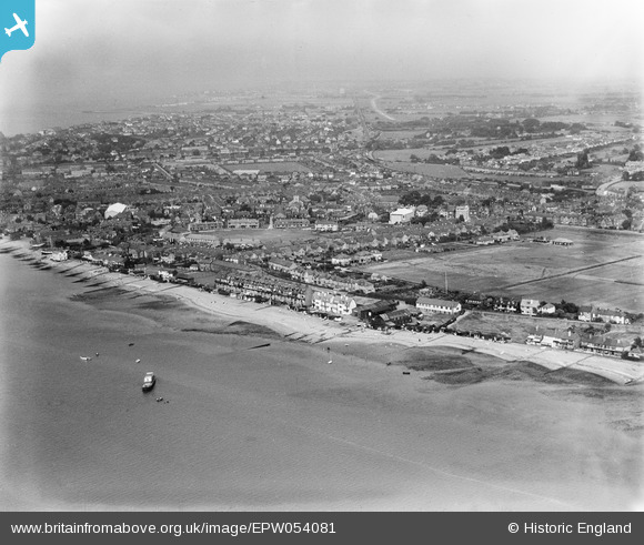
EPW054081 ENGLAND (1937). Lower Island and the town, Whitstable, from the north-west, 1937
© Hawlfraint cyfranwyr OpenStreetMap a thrwyddedwyd gan yr OpenStreetMap Foundation. 2026. Trwyddedir y gartograffeg fel CC BY-SA.
Delweddau cyfagos (3)
EPW054081

EPW018616

EPW018615

Manylion
| Pennawd | [EPW054081] Lower Island and the town, Whitstable, from the north-west, 1937 |
| Cyfeirnod | EPW054081 |
| Dyddiad | June-1937 |
| Dolen | |
| Enw lle | WHITSTABLE |
| Plwyf | |
| Ardal | |
| Gwlad | ENGLAND |
| Dwyreiniad / Gogleddiad | 610232, 166395 |
| Hydred / Lledred | 1.019891687019, 51.357164702044 |
| Cyfeirnod Grid Cenedlaethol | TR102664 |
Pinnau

Sparky |
Wednesday 9th of September 2020 04:04:37 PM | |
|
Sparky |
Sunday 13th of August 2017 01:00:08 PM | |
|
Sparky |
Sunday 13th of August 2017 12:58:38 PM | |
|
Sparky |
Sunday 13th of August 2017 12:57:36 PM |