
EPW053689 ENGLAND (1937). Wealdstone Baptist Church, the High Street and environs, Wealdstone, 1937

© Hawlfraint cyfranwyr OpenStreetMap a thrwyddedwyd gan yr OpenStreetMap Foundation. 2026. Trwyddedir y gartograffeg fel CC BY-SA.
Delweddau cyfagos (8)
EPW053689

EPW053684

EPW053685

EAW021395

EAW021399

EPW035058

EAW021400
, Wealdstone, 1949. This image has been produced from a damaged negative.")
EAW021397

Manylion
| Pennawd | [EPW053689] Wealdstone Baptist Church, the High Street and environs, Wealdstone, 1937 |
| Cyfeirnod | EPW053689 |
| Dyddiad | 12-June-1937 |
| Dolen | |
| Enw lle | WEALDSTONE |
| Plwyf | |
| Ardal | |
| Gwlad | ENGLAND |
| Dwyreiniad / Gogleddiad | 515403, 189939 |
| Hydred / Lledred | -0.33372220791861, 51.595987908506 |
| Cyfeirnod Grid Cenedlaethol | TQ154899 |
Pinnau

Bill P |
Monday 29th of October 2018 05:03:34 PM | |
|
Bill P |
Monday 29th of October 2018 04:58:15 PM | |
|
Bill P |
Monday 29th of October 2018 04:10:57 PM | |
|
Bill P |
Monday 29th of October 2018 04:08:55 PM | |
|
Bill P |
Monday 29th of October 2018 04:07:37 PM | |
|
Bill P |
Monday 29th of October 2018 04:05:27 PM | |
|
simes188 |
Sunday 16th of April 2017 06:56:32 PM | |
|
simes188 |
Tuesday 4th of February 2014 08:53:46 PM | |
|
simes188 |
Tuesday 4th of February 2014 08:10:57 PM | |
|
simes188 |
Sunday 24th of November 2013 10:31:05 PM | |
|
simes188 |
Sunday 24th of November 2013 10:26:39 PM | |
Now a Costa Coffee |
simes188 |
Friday 21st of April 2017 01:41:00 PM |
|
JamesMac |
Thursday 31st of October 2013 04:29:19 AM | |
|
JamesMac |
Thursday 31st of October 2013 04:04:51 AM | |
|
JamesMac |
Thursday 31st of October 2013 04:00:07 AM | |
No longer there. Now flats & retail. |
simes188 |
Sunday 24th of November 2013 10:29:15 PM |
Been demolished and very recently replaced by flats and a retail unit. |
simes188 |
Tuesday 4th of February 2014 08:58:20 PM |
|
JamesMac |
Thursday 31st of October 2013 03:58:34 AM | |
|
JamesMac |
Thursday 31st of October 2013 03:56:45 AM | |
Became the Police Station when the library moved to Grant Road |
simes188 |
Sunday 24th of November 2013 10:27:48 PM |
Was the library before it was the nick. Library moved to Grant Road in the sixties and is now further along the High Street. |
simes188 |
Tuesday 4th of February 2014 08:56:45 PM |
The library was on the West side and the police station on the East side. Behind was Grant Road School. |
PeterW |
Thursday 6th of March 2014 12:09:03 AM |
|
JamesMac |
Thursday 31st of October 2013 03:54:18 AM | |
|
JamesMac |
Thursday 31st of October 2013 03:53:33 AM | |
|
JamesMac |
Thursday 31st of October 2013 03:52:52 AM | |
|
JamesMac |
Thursday 31st of October 2013 03:52:08 AM | |
|
JamesMac |
Thursday 31st of October 2013 03:49:24 AM | |
|
JamesMac |
Thursday 31st of October 2013 03:42:42 AM | |
|
JamesMac |
Thursday 31st of October 2013 03:41:36 AM | |
Yes, that certainly is Grant Road School, or was! |
Sweet Pete |
Saturday 31st of January 2015 05:44:59 PM |
|
kels |
Friday 5th of July 2013 05:45:39 PM |
Cyfraniadau Grŵp
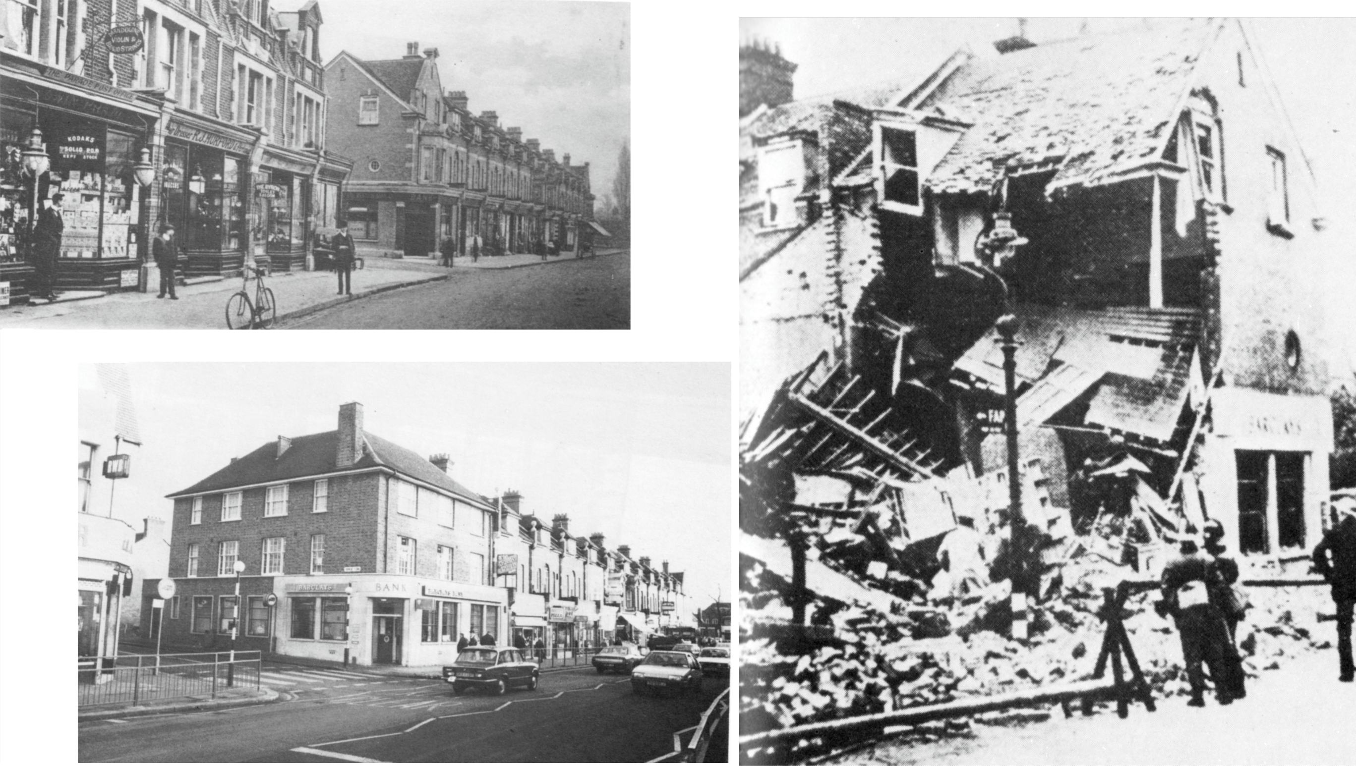
Building destroyed in a German air raid three years after this photo and subsequently rebuilt |
czyrko |
Saturday 26th of April 2014 05:46:03 PM |