
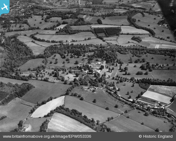
EPW053336 ENGLAND (1937). Parkland and surrounding fields, Thorncombe Park, 1937. This image has been produced from a print.
© Hawlfraint cyfranwyr OpenStreetMap a thrwyddedwyd gan yr OpenStreetMap Foundation. 2026. Trwyddedir y gartograffeg fel CC BY-SA.
Delweddau cyfagos (2)
EPW053336

EPW053335

Manylion
| Pennawd | [EPW053336] Parkland and surrounding fields, Thorncombe Park, 1937. This image has been produced from a print. |
| Cyfeirnod | EPW053336 |
| Dyddiad | 27-May-1937 |
| Dolen | |
| Enw lle | THORNCOMBE PARK |
| Plwyf | BRAMLEY |
| Ardal | |
| Gwlad | ENGLAND |
| Dwyreiniad / Gogleddiad | 500272, 143066 |
| Hydred / Lledred | -0.56535522760179, 51.177504947 |
| Cyfeirnod Grid Cenedlaethol | TQ003431 |
Pinnau
Byddwch y cyntaf i ychwanegu sylw at y ddelwedd hon!
Cyfraniadau Grŵp
The whole look of the picture suggest thin soils over chalk, that may help narrow the area down. |

rog8811 |
Friday 14th of November 2014 01:39:39 PM |
I thought that too, but strangely not. It is the Hythe beds of the Greensand belt. |
TomRobin |
Friday 14th of November 2014 01:39:39 PM |

Large house in the South of England with its own park and kitchen garden |
AnthonyN8 |
Thursday 13th of November 2014 10:56:14 PM |
Thorncombe Park near Godalming |
TomRobin |
Thursday 13th of November 2014 10:56:14 PM |
Thorncombe Park |
TomRobin |
Thursday 13th of November 2014 10:55:36 PM |
epw053330, epw053331, epw053332, epw053335, epw053339, epw053340 are all the same area. |
nkingdon |
Wednesday 29th of October 2014 11:33:26 PM |