
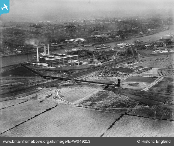
EPW049213 ENGLAND (1935). Dunston A and B Power Stations, Dunston, from the south-west, 1935
© Hawlfraint cyfranwyr OpenStreetMap a thrwyddedwyd gan yr OpenStreetMap Foundation. 2026. Trwyddedir y gartograffeg fel CC BY-SA.
Delweddau cyfagos (4)
EPW049213

EPW049215

EPW049208

EPW049210

Manylion
| Pennawd | [EPW049213] Dunston A and B Power Stations, Dunston, from the south-west, 1935 |
| Cyfeirnod | EPW049213 |
| Dyddiad | September-1935 |
| Dolen | |
| Enw lle | DUNSTON |
| Plwyf | |
| Ardal | |
| Gwlad | ENGLAND |
| Dwyreiniad / Gogleddiad | 421400, 562565 |
| Hydred / Lledred | -1.6657832900497, 54.957187297281 |
| Cyfeirnod Grid Cenedlaethol | NZ214626 |
Pinnau
Byddwch y cyntaf i ychwanegu sylw at y ddelwedd hon!