
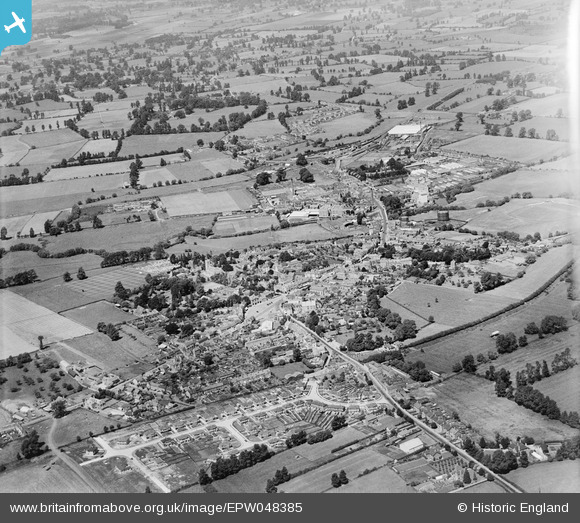
EPW048385 ENGLAND (1935). The town, Melksham, from the south-east, 1935
© Hawlfraint cyfranwyr OpenStreetMap a thrwyddedwyd gan yr OpenStreetMap Foundation. 2026. Trwyddedir y gartograffeg fel CC BY-SA.
Delweddau cyfagos (3)
EPW048385

 0°
0m
0°
0m
EPW041315
 251°
185m
251°
185m
EPW048384
 224°
282m
224°
282m
Manylion
| Pennawd | [EPW048385] The town, Melksham, from the south-east, 1935 |
| Cyfeirnod | EPW048385 |
| Dyddiad | July-1935 |
| Dolen | |
| Enw lle | MELKSHAM |
| Plwyf | MELKSHAM |
| Ardal | |
| Gwlad | ENGLAND |
| Dwyreiniad / Gogleddiad | 390640, 163440 |
| Hydred / Lledred | -2.1344746679755, 51.36944448659 |
| Cyfeirnod Grid Cenedlaethol | ST906634 |
Pinnau

Class31 |
Wednesday 24th of July 2013 04:27:55 PM | |
|
Class31 |
Wednesday 24th of July 2013 04:19:32 PM | |
|
Class31 |
Wednesday 24th of July 2013 04:17:20 PM | |
|
Class31 |
Wednesday 24th of July 2013 04:15:07 PM | |
|
Class31 |
Wednesday 24th of July 2013 04:12:45 PM | |
 Bed of the disused Wilts & Berks Canal. Bed of the disused Wilts & Berks Canal. |
Class31 |
Sunday 30th of June 2013 06:37:22 PM |
| Christ Church, Shaw |
Class31 |
Sunday 30th of June 2013 06:35:51 PM |


