
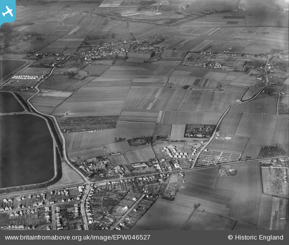
EPW046527 ENGLAND (1935). Land to the east of the Staines Reservoirs, Stanwell, 1935
© Hawlfraint cyfranwyr OpenStreetMap a thrwyddedwyd gan yr OpenStreetMap Foundation. 2026. Trwyddedir y gartograffeg fel CC BY-SA.
Delweddau cyfagos (4)
EPW046527

EPW046526

EPW046528

EPW046529

Manylion
| Pennawd | [EPW046527] Land to the east of the Staines Reservoirs, Stanwell, 1935 |
| Cyfeirnod | EPW046527 |
| Dyddiad | February-1935 |
| Dolen | |
| Enw lle | STANWELL |
| Plwyf | |
| Ardal | |
| Gwlad | ENGLAND |
| Dwyreiniad / Gogleddiad | 506258, 173248 |
| Hydred / Lledred | -0.47074666473004, 51.447747957122 |
| Cyfeirnod Grid Cenedlaethol | TQ063732 |
Pinnau


Cyfraniadau Grŵp

London Road at Stanwell Road, Ashford, 07/09/2015 |

Class31 |
Tuesday 15th of September 2015 04:25:56 PM |