
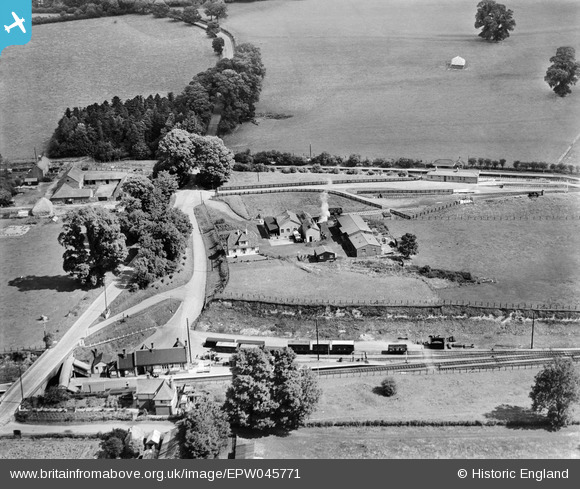
EPW045771 ENGLAND (1934). Wiltshire Creameries Ltd Milk Factory and Savernake Station, Burbage, 1934
© Hawlfraint cyfranwyr OpenStreetMap a thrwyddedwyd gan yr OpenStreetMap Foundation. 2024. Trwyddedir y gartograffeg fel CC BY-SA.
Delweddau cyfagos (6)
EPW045771

EPW045768

EPW045769

EPW045766

EPW045770

EPW045767

Manylion
| Pennawd | [EPW045771] Wiltshire Creameries Ltd Milk Factory and Savernake Station, Burbage, 1934 |
| Cyfeirnod | EPW045771 |
| Dyddiad | August-1934 |
| Dolen | |
| Enw lle | BURBAGE |
| Plwyf | BURBAGE |
| Ardal | |
| Gwlad | ENGLAND |
| Dwyreiniad / Gogleddiad | 423677, 163291 |
| Hydred / Lledred | -1.659846328756, 51.367688009218 |
| Cyfeirnod Grid Cenedlaethol | SU237633 |
Pinnau
 Class31 |
Monday 5th of August 2013 10:21:11 AM | |
Class31 |
Monday 5th of August 2013 10:18:57 AM | |
 |
Class31 |
Monday 5th of August 2013 10:04:23 AM |
Class31 |
Monday 5th of August 2013 10:00:22 AM | |
Class31 |
Sunday 4th of August 2013 08:50:04 PM | |
 MB |
Monday 6th of May 2013 10:25:55 AM | |
MB |
Monday 6th of May 2013 10:24:22 AM | |
MB |
Monday 6th of May 2013 10:23:05 AM | |
MB |
Monday 6th of May 2013 10:21:24 AM | |
MB |
Monday 6th of May 2013 10:15:03 AM |


Cyfraniadau Grŵp
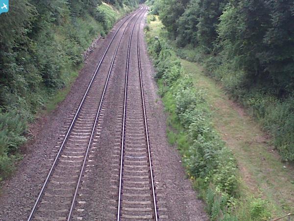
 View from the bridge over the railway looking east at the site of Savernake Low Level Railway Station on the Westbury to Newbury line. |
Class31 |
Monday 5th of August 2013 09:54:44 AM |


