
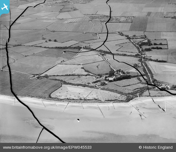
EPW045533 ENGLAND (1934). The beach, Bailiffscourt and surrounding countryside, Atherington, from the south, 1934. This image has been produced from a damaged negative.
© Hawlfraint cyfranwyr OpenStreetMap a thrwyddedwyd gan yr OpenStreetMap Foundation. 2026. Trwyddedir y gartograffeg fel CC BY-SA.
Delweddau cyfagos (24)
EPW045533

EPW062497

EPW062496

EPW062498

EPW020165

EPW062495

EPW020155

EPW062503

EPW020167

EPW020162

EPW045531

EPW062494

EPW020160

EPW020171

EPW020153

EPW045538

EPW020169

EPW020156

EPW020164

EPW045536

EPW020148

EPW045532

EPW020161

EPW062504

Manylion
| Pennawd | [EPW045533] The beach, Bailiffscourt and surrounding countryside, Atherington, from the south, 1934. This image has been produced from a damaged negative. |
| Cyfeirnod | EPW045533 |
| Dyddiad | July-1934 |
| Dolen | |
| Enw lle | ATHERINGTON |
| Plwyf | CLIMPING |
| Ardal | |
| Gwlad | ENGLAND |
| Dwyreiniad / Gogleddiad | 500145, 100654 |
| Hydred / Lledred | -0.57886487992735, 50.796221905256 |
| Cyfeirnod Grid Cenedlaethol | TQ001007 |
Pinnau
Byddwch y cyntaf i ychwanegu sylw at y ddelwedd hon!