
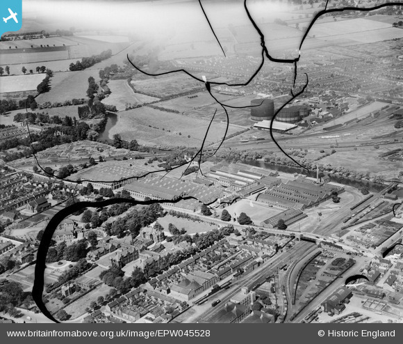
EPW045528 ENGLAND (1934). The Britannia Iron Works and the environs, Bedford, 1934. This image has been produced from a damaged negative.
© Hawlfraint cyfranwyr OpenStreetMap a thrwyddedwyd gan yr OpenStreetMap Foundation. 2026. Trwyddedir y gartograffeg fel CC BY-SA.
Delweddau cyfagos (26)
EPW045528

EAW032058

EPW045529

EPW046433

EAW032059

EPW045525

EPW022385

EPW045530

EAW032055

EPW046441

EAW032051

EPW046432

EAW032063

EAW032052

EAW032062

EAW032054

EPW026475

EAW032060

EAW032056

EAW032053

EPW045526

EAW032057

EPW037466

EPW046442

EPW037463

EPW022392

Manylion
| Pennawd | [EPW045528] The Britannia Iron Works and the environs, Bedford, 1934. This image has been produced from a damaged negative. |
| Cyfeirnod | EPW045528 |
| Dyddiad | July-1934 |
| Dolen | |
| Enw lle | BEDFORD |
| Plwyf | |
| Ardal | |
| Gwlad | ENGLAND |
| Dwyreiniad / Gogleddiad | 504396, 249040 |
| Hydred / Lledred | -0.47472138097195, 52.129382793148 |
| Cyfeirnod Grid Cenedlaethol | TL044490 |
Pinnau

melgibbs |
Thursday 5th of December 2013 07:47:27 PM |