
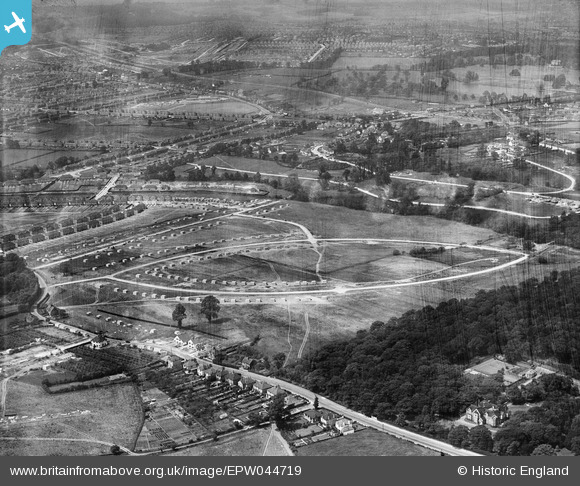
EPW044719 ENGLAND (1934). The Albany Park Estate under construction centred upon Murchison, Dorchester and Crofton Avenues, Bexley Woods, from the south-east, 1934
© Hawlfraint cyfranwyr OpenStreetMap a thrwyddedwyd gan yr OpenStreetMap Foundation. 2026. Trwyddedir y gartograffeg fel CC BY-SA.
Delweddau cyfagos (6)
EPW044719

EPW044718

EPW044374

EPW044377

EPW044378

EPW044721

Manylion
| Pennawd | [EPW044719] The Albany Park Estate under construction centred upon Murchison, Dorchester and Crofton Avenues, Bexley Woods, from the south-east, 1934 |
| Cyfeirnod | EPW044719 |
| Dyddiad | June-1934 |
| Dolen | |
| Enw lle | BEXLEY WOODS |
| Plwyf | |
| Ardal | |
| Gwlad | ENGLAND |
| Dwyreiniad / Gogleddiad | 548106, 173376 |
| Hydred / Lledred | 0.13119405055487, 51.439499543814 |
| Cyfeirnod Grid Cenedlaethol | TQ481734 |
Pinnau
Byddwch y cyntaf i ychwanegu sylw at y ddelwedd hon!