
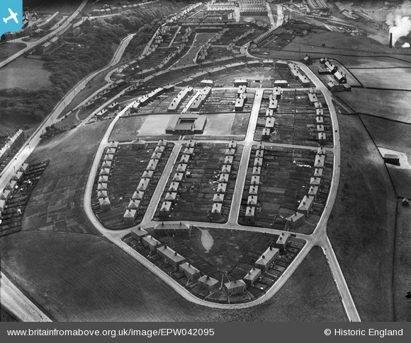
EPW042095 ENGLAND (1933). Bransty Primary School and surrounding housing estate, Whitehaven, 1933
© Hawlfraint cyfranwyr OpenStreetMap a thrwyddedwyd gan yr OpenStreetMap Foundation. 2026. Trwyddedir y gartograffeg fel CC BY-SA.
Delweddau cyfagos (2)
EPW042095

EPW029187

Manylion
| Pennawd | [EPW042095] Bransty Primary School and surrounding housing estate, Whitehaven, 1933 |
| Cyfeirnod | EPW042095 |
| Dyddiad | June-1933 |
| Dolen | |
| Enw lle | WHITEHAVEN |
| Plwyf | |
| Ardal | |
| Gwlad | ENGLAND |
| Dwyreiniad / Gogleddiad | 297846, 519477 |
| Hydred / Lledred | -3.5799228547436, 54.560075577373 |
| Cyfeirnod Grid Cenedlaethol | NX978195 |
Pinnau
Byddwch y cyntaf i ychwanegu sylw at y ddelwedd hon!
Cyfraniadau Grŵp
16 |

MotoFreako64 |
Friday 14th of June 2013 08:56:33 PM |