
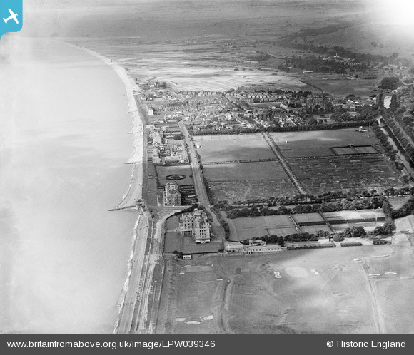
EPW039346 ENGLAND (1932). The Recreation Ground, South Road and environs, Hythe, from the north-east, 1932
© Hawlfraint cyfranwyr OpenStreetMap a thrwyddedwyd gan yr OpenStreetMap Foundation. 2026. Trwyddedir y gartograffeg fel CC BY-SA.
Delweddau cyfagos (5)
EPW039346

EPW000098

EPW000286

EPW026122

EPW026127

Manylion
| Pennawd | [EPW039346] The Recreation Ground, South Road and environs, Hythe, from the north-east, 1932 |
| Cyfeirnod | EPW039346 |
| Dyddiad | July-1932 |
| Dolen | |
| Enw lle | HYTHE |
| Plwyf | HYTHE |
| Ardal | |
| Gwlad | ENGLAND |
| Dwyreiniad / Gogleddiad | 616987, 134486 |
| Hydred / Lledred | 1.097470411019, 51.068091311547 |
| Cyfeirnod Grid Cenedlaethol | TR170345 |
Pinnau

John Llewellyn |
Wednesday 9th of November 2016 01:08:18 PM |