
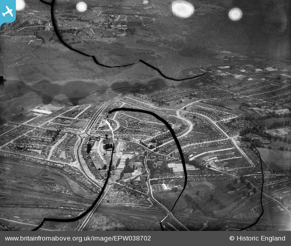
EPW038702 ENGLAND (1932). The Circle and housing off the North Circular Road, Neasden, from the south, 1932. This image has been produced from a damaged negative.
© Hawlfraint cyfranwyr OpenStreetMap a thrwyddedwyd gan yr OpenStreetMap Foundation. 2026. Trwyddedir y gartograffeg fel CC BY-SA.
Delweddau cyfagos (4)
EPW038702

EPW056898

EPW056897

EPW046500

Manylion
| Pennawd | [EPW038702] The Circle and housing off the North Circular Road, Neasden, from the south, 1932. This image has been produced from a damaged negative. |
| Cyfeirnod | EPW038702 |
| Dyddiad | June-1932 |
| Dolen | |
| Enw lle | NEASDEN |
| Plwyf | |
| Ardal | |
| Gwlad | ENGLAND |
| Dwyreiniad / Gogleddiad | 521424, 185784 |
| Hydred / Lledred | -0.24826575005659, 51.557376118374 |
| Cyfeirnod Grid Cenedlaethol | TQ214858 |
Pinnau
 |

Leslie B |
Sunday 2nd of December 2018 06:23:53 PM |

Class31 |
Monday 13th of October 2014 11:45:44 AM | |
|
Class31 |
Monday 13th of October 2014 11:44:55 AM | |
|
Class31 |
Sunday 2nd of March 2014 11:45:09 PM |

